 Hiking
 Login
Login More
More EN
EN Premium
Beemdenwandeling
10.3 km • Aarschot
 official route
route offered by
 Addresse starting point (approximate)
Kerkplein, 3130 Betekom (Begijnendijk)
 signage
The route is fully signposted with nodes.
 Description
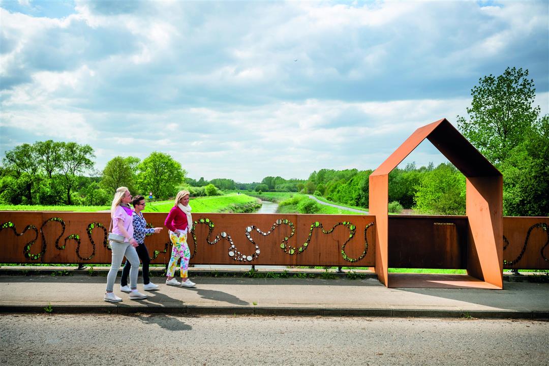
Along the Beemdenwandeling, you get acquainted with rural Betekom. The walk soon leads you, via unpaved roads, through the Beemden to the Demerdijk. Enjoy the nature on the banks of the Demer on the border of Betekom and Aarschot. In the Demer valley you walk through the Vorsdonkbos, a low-lying nature reserve, so don't forget your boots! Once off the Demer dike, the walk continues along fields and meadows to eventually take you back to the church square via the beautiful site of Putteberg.
This walk is offered by Tourism Flemish Brabant.
automatic translation
 nodes to follow
0 km
3.8 km
3.9 km
5.1 km
6.6 km
7.5 km
7.6 km
8.1 km
8.5 km
10.1 km
10.2 km
Thursday, April 8, 2021 by Jan TheunisNice hike, the passage through the part of natuurpunt was generally muddy.... but we are used to that from the areas managed by natuurpunt :-)
automatic translation
Saturday, January 23, 2021 by Peter WilsNice varied walk, over the dikes, through the fields, the center of Betekom and in our case through a muddy forest. There are works going on in the Vorsdonkbos and the machines and tractors broke everything, a pack of rain on top and you have a slippery track. Luckily only a small section, the rest was more fun. Still worth it though!
automatic translation
Monday, November 2, 2020 by Sonja Vanderstappenalways a little vacation feeling when you can walk along our rivers on the towpath, toll booth is photogenic spot
automatic translation
Monday, May 18, 2020 by A.S.Junction 711 at the Church of Betekom?
Junction to 712 from 711 not visible.
automatic translation
Saturday, May 16, 2020 by E.E.Very beautiful and pleasant hike! The Vorsdonk forest is beautiful
automatic translation
Saturday, December 28, 2019 by Johan GinkelsBeautiful walk, muddy here and there. Especially the Vorsdonk forest was mysteriously beautiful.
automatic translation


 Upgrade to Premium Plus
