 Hiking
 Login
Login
 More
More
 EN
EN
 Premium
Monument Walk Haacht-Wakkerzeel
11.2 km • Haacht
2.3834 2 4.5/5
route offered by
Toerisme Haacht
 Addresse starting point (approximate)
Hansbrugweg, 3150 Haacht
 signage
The route is fully signposted with nodes.
 Description
Explore the captivating history of Haacht during a tranquil walking or cycling tour of eleven kilometers, along some historical sights between Haacht and Wakkerzeel. This route takes you along various historical sites and interesting locations.
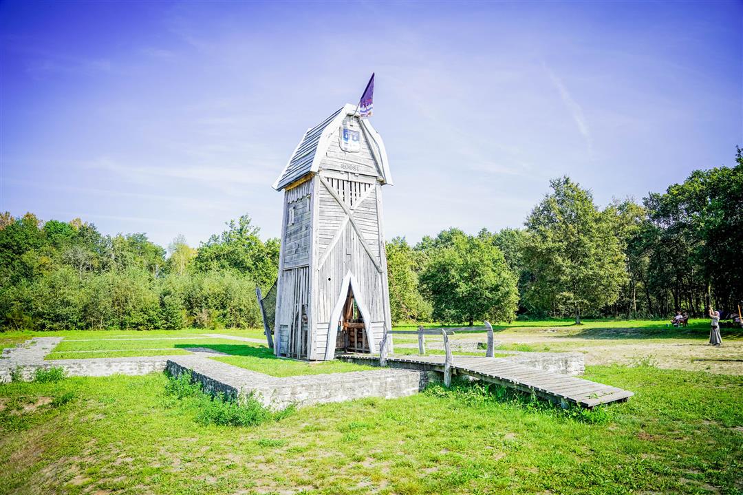
Embark on your discovery journey at the site of the Lordship of Roost on Hansbrugweg. A castle stood at this location from the fourteenth century, strategically positioned on the border between the spheres of influence of Mechelen and Leuven. The foundations are largely preserved on site. Currently, you'll find a delightful playground there.
This walk is offered by the municipality of Haacht.
 nodes to follow
0 km
0.1 km
0.5 km
2 km
2 km
2.1 km
3.1 km
3.5 km
4 km
4.5 km
5.7 km
5.8 km
6.3 km
7.6 km
7.8 km
9.1 km
9.1 km
10.6 km
11 km
11.2 km
Sunday, September 22, 2024 by Benjamin KeppensA pleasant walk on the third Saturday in September, the river full of duckweed ... and autumn literally in the air as the acorns fall on your head. The September sun still makes itself felt and shade at the beginning of the trail is welcome. Beautiful dry roads, monuments and small villages ...
automatic translation
Friday, March 29, 2024 by M.D.What a beautiful walk along quiet spots in Haacht and Wakkerzeel. The anti-tank ditch and the paths along it were flooded. There we took a detour via the Wilde Heide. So in wet weather, put on bones.
automatic translation


 Upgrade to Premium Plus
