 Hiking
 Login
Login
 More
More
 EN
EN
 Premium
Alsbergwandeling
6.5 km • Tielt-Winge
 official route
4.77815 5 3.8/5
route offered by
 Addresse starting point (approximate)
Huize Hageland, Oude Pastoriestraat 22, 3390 Tielt-Winge
 signage
The route is fully signposted with nodes.
 Description
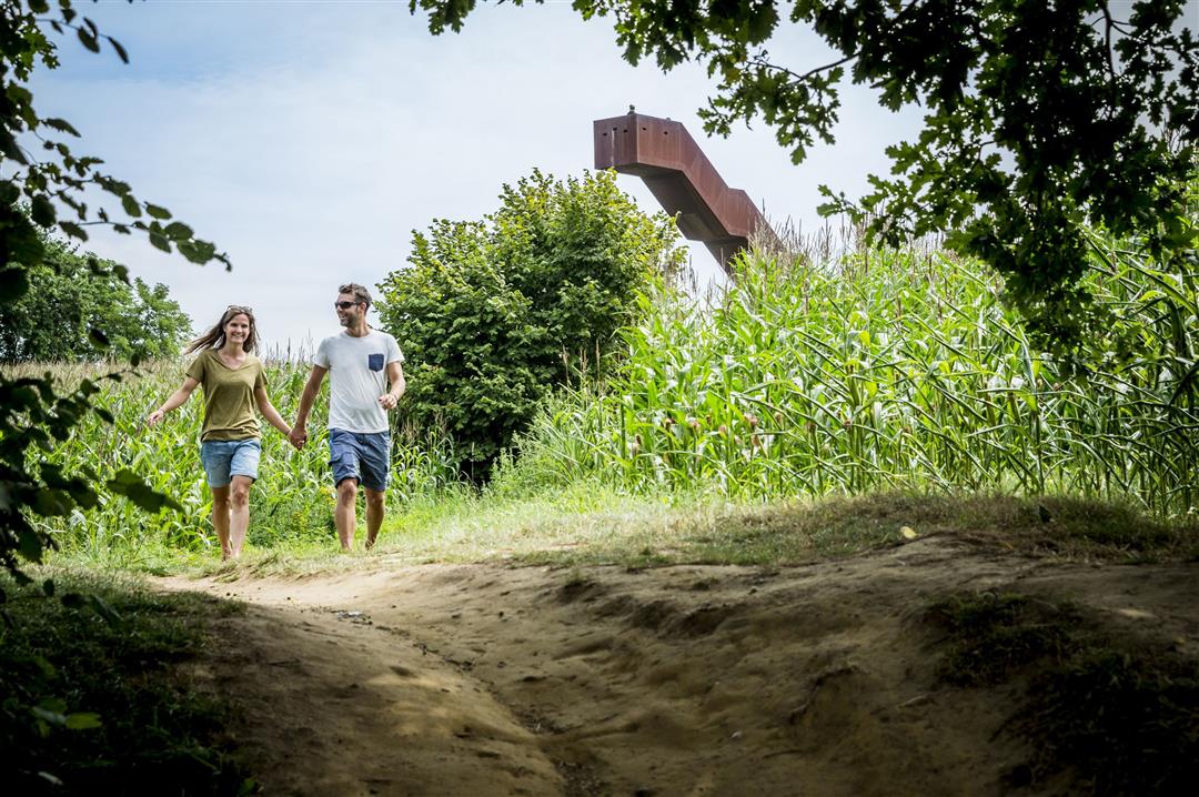
Explore the hamlets of Alsberg and Tielt in the distinctive hilly landscape of the Hageland. Enjoy the stunning views. The very best view awaits you at the Vlooyberg Tower, an 11-meter-high floating staircase made of rust-brown Corten steel. You might remember it from the TV series Callboys. Halfway through your walk, you’ll enter the damp Walenbos, Flanders’ largest alder forest, home to wonderful flora and fauna.
automatic translation
 nodes to follow
0 km
0.6 km
1.1 km
1.3 km
1.6 km
1.7 km
3.8 km
5.2 km
5.2 km
5.3 km
6 km
6.5 km
Sunday, November 29, 2020 by fran uyttebroukpleasant walking with a variety of views [forest - open fields]
automatic translation
Monday, August 3, 2020 by Robin Van De VeldeBeautiful hike, highly recommended!
Both forest and landscapes
Distance ideal, no cafe on route to take a break.
automatic translation
Sunday, July 26, 2020 by Kumps RiaVacation feeling. Very green surroundings with the vlooyberg tower as a landmark. Benches and table along the way to have a picnic in the walembos. On the route itself no cafe but if you deviate from the route for a while you can.
automatic translation
Sunday, December 22, 2019 by S.H.Very nice hike very varied with beautiful views. Also nice that there is enough space at the starting point to park the car.
Too bad there was no inn to warm up ...
automatic translation
Sunday, November 10, 2019 by K.V.Nice walk, not too long and not too short, nice alternation of very quiet tracks and forest. But beware in the forest you come across a fenced area, here you go through a gate which is very tight if you walk with your dog, and there is electricity on the fence! My dogs will have known 🤔
automatic translation


 Upgrade to Premium Plus
