 Hiking
 Login
Login
 More
More
 EN
EN
 Premium
Along fens and forests
automatic translation
8.7 km • Scherpenheuvel-Zichem
 official route
8.16218 3 5/5
 Addresse starting point (approximate)
Abdij van Averbode, Abdijstraat 1
 signage
The route is fully signposted with nodes.
 Description
Before you leave, take a moment to enjoy the beautiful courtyard of Averbode Abbey.
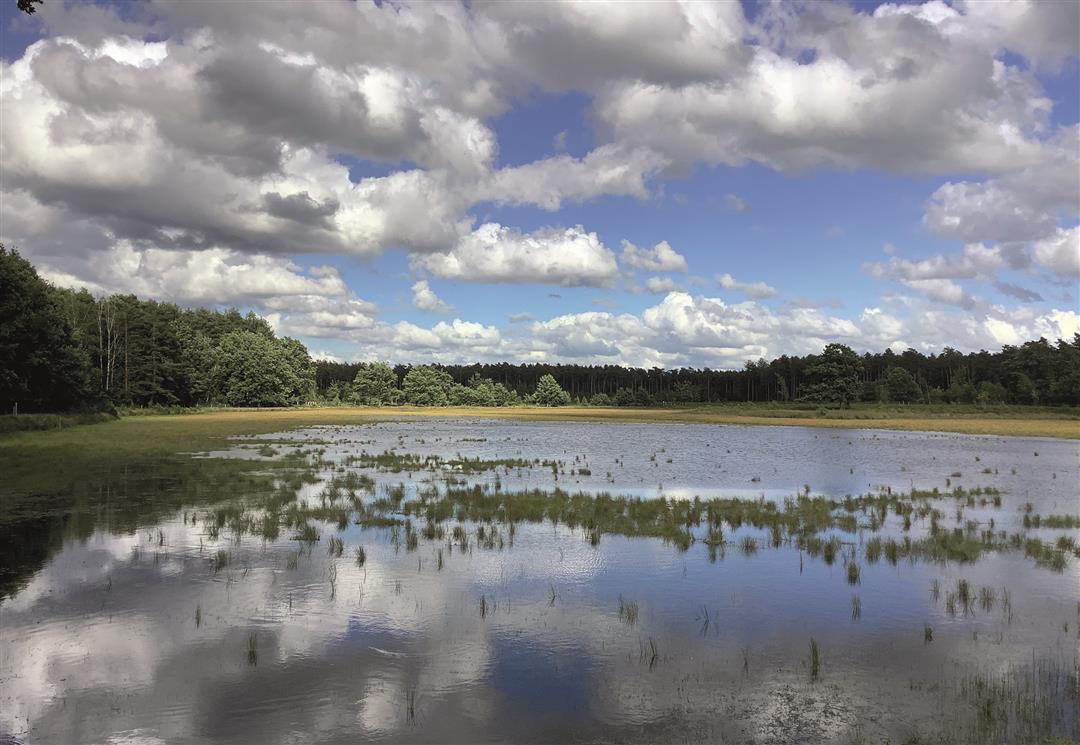
Walk straight through the Averbode Bos and Heide nature reserve to the toothache chapel. Thanks to the chapel's location near ven Nooitgedacht and the Eikenboschven, this is one of the most beautiful spots in the area.
A few kilometers further on you come to the Klompenmuseum via another fen, the Langven.
On the other side of the Herseltsesteenweg another piece of Averbode Forest and Heath awaits. Here too you pass some beautiful fens. Via the wooded lane you return to your
starting point.
Want to end in beauty? Visit the Abbey store and the Abbey café of the experience center Het Moment. Enjoy all the goodies from the region.
automatic translation
 nodes to follow
0 km
0.6 km
0.7 km
0.9 km
2 km
2.5 km
2.7 km
3.5 km
4.3 km
5 km
5.5 km
5.7 km
5.8 km
6.7 km
6.9 km
7.1 km
7.2 km
7.5 km
7.7 km
8 km
8.7 km
8.7 km
Thursday, October 9, 2025 by J.O.Hugely beautiful. Lots of forest and heather, just what we were looking for.
automatic translation
Sunday, June 1, 2025 by Nancy BelmansBeautiful hike,as mentioned before very quiet and beautiful walk.We started at junction 251 and so then walked towards the abbey.At the abbey enjoyed a nice lunch and a nice abbey beer.The tour did not bore a minute because it is so quiet and beautiful.Highly recommended.
automatic translation
Wednesday, March 19, 2025 by J.V.Wonderful hike! Quiet too, despite being a popular area. Lots of different, vast landscapes and beautiful views everywhere. Mostly on forest trails, which can be boggy so good footwear recommended. At about 5-6 km there is a bistro. We did not find the road to point 251 so we skipped it.
automatic translation


 Upgrade to Premium Plus
