 Hiking
 Login
Login
 More
More
 EN
EN
 Premium
Mountain hike in Voeren
automatic translation
20 km • Voeren
 official route
15.22334 4 3.6/5
 Addresse starting point (approximate)
Sint-Martinuskerk, Kwinten, Voeren
 signage
The route is fully signposted with nodes.
 Description
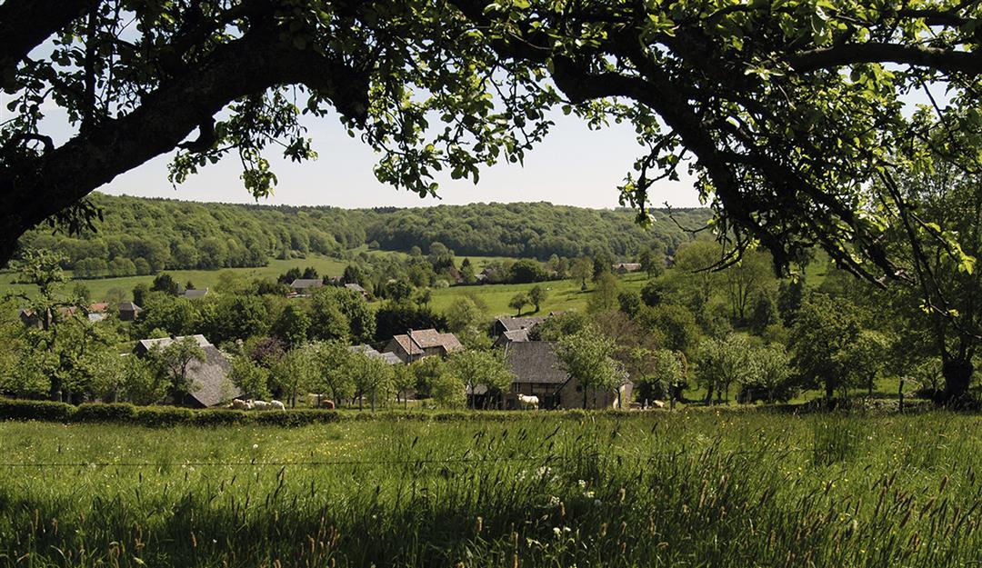
Grease your calves, lace up your hiking boots, strap on your backpack and traverse cow pastures, streams and scrubland with your walking sticks at the ready in search of adventure and the most beautiful valley views. For that you don't have to go to the Alps, Pyrenees or Dolomites. The Limburg answer lies in the highest municipality in Flanders, the idyllic place where the Sound of Music resounds from half-timbered houses in both Dutch and French, where badgers build their fortresses among the vines and hillside groves, and where trout jump straight from the castle pond onto your plate. Voeren, the highlight for hikers in Flanders, is at your feet.
automatic translation
 nodes to follow
0 km
0 km
0.3 km
2 km
2.5 km
3.9 km
4.5 km
4.6 km
4.8 km
6.2 km
6.2 km
6.9 km
7 km
7.9 km
8.7 km
10.6 km
11.8 km
12.4 km
12.5 km
13.1 km
13.3 km
13.8 km
14.1 km
15.1 km
15.9 km
17.4 km
18.6 km
19 km
19.3 km
19.6 km
20 km
Thursday, May 7, 2026 by S.P.All right, but as mentioned earlier, there’s a numbering issue when crossing into the Netherlands. Some signs are missing—number 41 is missing. Also, numbers 39, 37, and 57 are sometimes numbered differently because we’re in the Netherlands. Luckily, we had the app. In the end, you need to take 41–39–37–65–93–57–52
automatic translation
Thursday, April 23, 2026 by Stefanie CremersIn some places, the signage was very unclear because signs were missing or the numbers on the signs were incorrect
automatic translation
Thursday, November 13, 2025 by Koen FollongBeautiful, varied hike with plenty of rest stops along the way. Some times the numbering did let us down, so we had to fall back on the GPX.
automatic translation
Saturday, June 29, 2024 by Mustafa KarabalWonderful discovery of this beautiful region that I visit regularly. Thanks to nodemapp for this trail that I really enjoyed.
automatic translation
Monday, April 14, 2025 by Jonathan WoutersVery nice walk now that the blossoms are there (13/4/25). Walked a little wrong at point 57, was not clear to me, so it became 22 km. Definitely worth it!
automatic translation


 Upgrade to Premium Plus
