 Hiking
 Login
Login
 More
More
 EN
EN
 Premium
Meensel-Kiezegemwandeling
14.3 km • Tielt-Winge
 official route
5.08015 2 4/5
route offered by
 Addresse starting point (approximate)
Ontmoetingscentrum, Kapellekensweg 30, 3391 Meensel-Kiezegem (Tielt-Winge)
 signage
The route is not signposted. Use a GPS device or our app to follow the route through the virtual nodes.
 Description
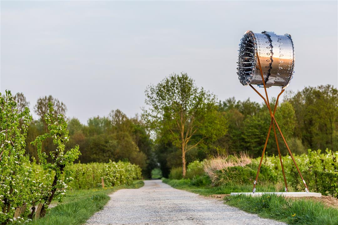
Discover Eddy Merckx’s hometown: Meensel-Kiezegem. His statue stands in front of his birthplace, but the locals are even prouder of their fruit. Nowhere else in Flemish Brabant will you find so many apple and pear orchards that form a beautiful sea of blossoms in April. Winding your way through the orchards, you’ll come across unique works of art—*Symbiose* and *De Reis*—paying homage to fruit growing. Looking for a souvenir? You’ll find one at the Fruit Vanhellemont farm shop.
automatic translation
 nodes to follow
0 km
1.1 km
1.8 km
3.4 km
4.5 km
5 km
5.3 km
6.5 km
7.8 km
9.1 km
11.1 km
11.8 km
14.3 km

14.3 km

14.3 km
Sunday, April 12, 2026 by jozef lievensnice walk
automatic translation
Sunday, April 14, 2024 by D.C.We did this hike on 13/4/2024. The hike is very beautiful. It goes up and down a bit through fields and fruit plantations (blossoms!) and you pass some nice hollow roads. Café 't Klein Verlet (at the monument in honor of Eddy Merckx) is definitely recommended to refuel. Only downside: there are not many benches :-)
automatic translation


 Upgrade to Premium Plus
