 Hiking
 Login
Login
 More
More
 EN
EN
 Premium
Weg-Om Walk
5.6 km • Halle
2.4424 0 0/5
route offered by
Toerisme Halle
 Addresse starting point (approximate)
St Martin's Basilica - Grote Markt
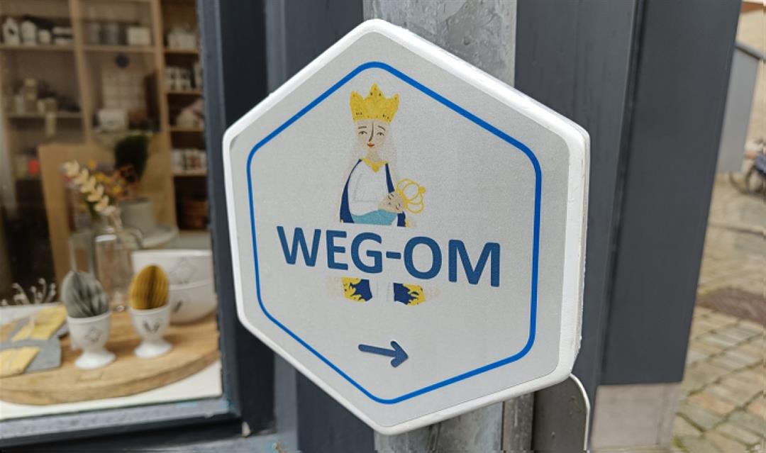
 signage
The route is fully signposted with thematic signs (no nodes).
 Description
The Weg-Om is one of the oldest procession routes in the country and connects various chapels in the centre of Halle and in the fields just outside the city. It's a stunning walk that should have pride of place on any bucket list! The 5.6 km route takes you past a series of chapels, crucifixes and wall niches that continue to attract countless visitors to this day. Wander through the charming city centre, enjoy the beauty of nature and learn more about the historic roots of Halle as a pilgrimage site.
Note: Follow the Maria signs indicating the route.
This walk is offered by the city of Halle.
 nodes to follow
0 km

0.1 km
0.2 km
0.7 km
1 km
1.8 km
1.9 km
2.4 km
2.8 km
3.2 km
3.4 km
3.5 km
3.8 km
3.9 km
4 km
4.2 km
4.5 km
4.7 km
5 km
5.3 km
5.5 km

5.6 km


 Upgrade to Premium Plus
