 Hiking
 Login
Login
 More
More
 EN
EN
 Premium
From Castle to Footbridge
automatic translation
7.6 km • Bouillon
4.86516 1 4/5
route offered by
 Addresse starting point (approximate)
Bld Vauban 20, 6830 Bouillon, België
 signage
The route is not signposted. Use a GPS device or our app to follow the route through the virtual nodes.
 Description
This walk starts in the shadow of the imposing Bouillon Castle, a medieval fortress perched high that has watched over the surrounding area for centuries. Feel the rich history as you admire its sturdy walls and the massive Austrian tower, silent witnesses to a glorious past.
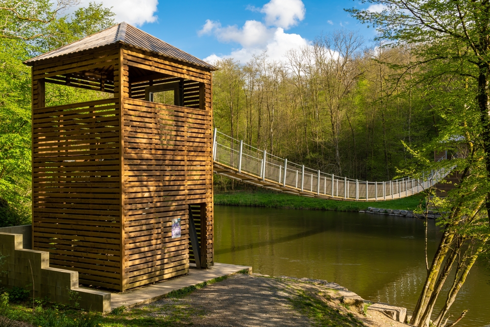
Further along your path, the Belvédère d'Auclin entices you with its breathtaking panoramas. Take the time from this lookout tower to take in the loop of the Semois river and the surrounding nature – a perfect photo opportunity. After 4 km, you reach La Passerelle de l’Epine, a beautiful footbridge 55 meters long and one of the longest suspension bridges in Wallonia. It spans the Semois from one bank to the other.
automatic translation
 nodes to follow
0 km
0.2 km
1.6 km
1.9 km
2.1 km
2.2 km
3.9 km
3.9 km
4.1 km
5.5 km
5.5 km
5.8 km
6.5 km
7.5 km
7.6 km
Saturday, October 25, 2025 by Lieven MestdaghVery nice hike. Very varied, first a climb to the Belvedere with tower, then through forests slightly descending towards the Semois (last part a bit steeper). Over the beautiful suspension bridge and the last part along the Semois back towards Bouillon. Highly recommended!
automatic translation


 Upgrade to Premium Plus
