 Hiking
 Login
Login
 More
More
 EN
EN
 Premium
Castle and Treetop Trail
automatic translation
11.8 km • Gemert-Bakel
1.7666 1 1/5
route offered by
 Addresse starting point (approximate)
Ridderplein 7-3, 5421 CV Gemert, Nederland
 signage
The route is fully signposted with nodes.
 Description
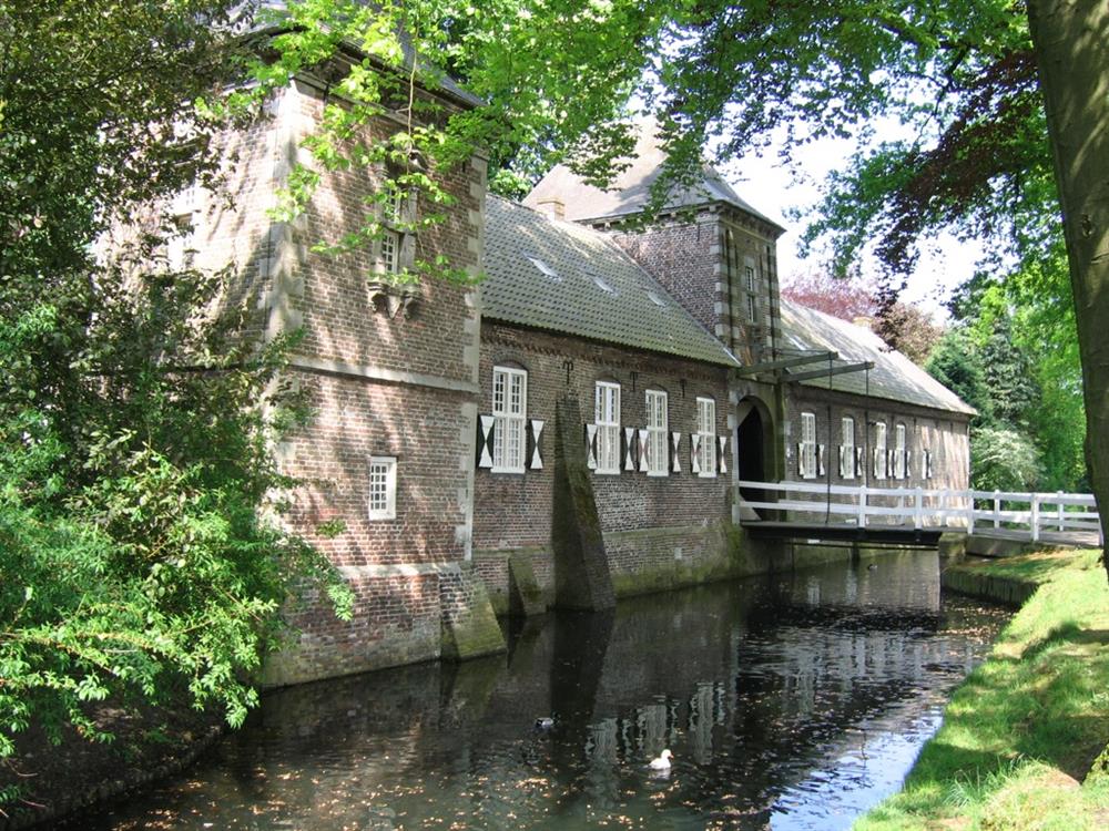
Discover the charm of historic and nature-rich North Brabant on this 11.8 km walking route, where both culture and nature are central themes. Begin your journey at the age-old Castle of Gemert. Situated on Kasteellaan leading to Ridderplein, it was founded by the knights of the Teutonic Order and has a rich history. Stroll through the beautiful castle gardens and be enchanted by the main building from the 18th century, erected in the Louis XIV style. With a past as a cotton spinning mill and a residence for fathers, you are entering a place where stories from different periods converge.
Further on, the green heart of the North Brabant landscape reveals itself in Het Hurkske, an oasis of tranquility and natural beauty. Marvel at the diversity of conifers and deciduous trees that began to shape the area since the early 20th century. The Rauwven and the budding Hurkse Loop enrich the landscape, where amphibians such as the alpine newt and the rare garlic toad have found refuge.
automatic translation
 nodes to follow
0 km
0.5 km
0.9 km
1.7 km
3.5 km
4.8 km
5.2 km
5.7 km
6.3 km
6.5 km
6.7 km
7.6 km
10.1 km
10.9 km
11.8 km
11.8 km


 Upgrade to Premium Plus
