 Hiking
 Login
Login
 More
More
 EN
EN
 Premium
Along the Irish Tower
automatic translation
10.8 km • Heuvelland
4.80712 4 4.6/5
route offered by
 Addresse starting point (approximate)
Kapelaniestraat 5, 8953 Heuvelland, België
 signage
The route is fully signposted with nodes.
 Description
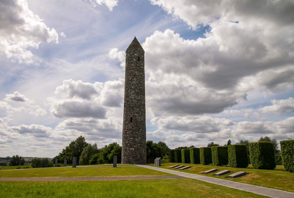
Discover the tumultuous history and picturesque surroundings on this unique 10.8 km walking route. You will explore the Irish Peace Park in Messines, a municipality with deep roots in World War I. The park, with its impressive tower built in honor of the Irish soldiers, is a UNESCO World Heritage site.
Continue your journey to the Messines Ridge British Cemetery, where thousands of brave souls have their final resting place. The beautifully maintained cemetery, overseen by the Commonwealth War Graves Commission, connects you with the tangible memories of the sacrifices made here. Close to this historically charged site, you will find the Messines Ridge. This renowned climb provides a breathtaking view over the surrounding landscape. The route also passes by the Spanbroekmolen British Cemetery in Wijtschate. Here you have the chance to pause again and reflect on the history of the region, before completing your walk.
automatic translation
 nodes to follow
0 km
0.8 km
3.6 km
3.7 km
4.1 km
4.9 km
5.7 km
7.2 km
7.3 km
7.7 km
7.7 km
8.2 km
8.9 km
9.2 km
9.7 km
9.9 km
10.3 km
10.8 km
Tuesday, July 7, 2026 by Lynsey CoustenobleA very nice route! Stunning views
automatic translation
Sunday, June 7, 2026 by hans sixStunning views, combined with plenty of World War I history in this beautiful, rolling region!
automatic translation
Friday, April 3, 2026 by OLIVIER DUPONTThis hike is truly a gem. It’s really wonderful, and it’s such a rare treat to be able to climb a church bell tower and take in the 360° view. The rolling fields and the woods are lovely, too. I’ve done this route several times now, and I never get tired of it. It’s truly perfect.
automatic translation
Sunday, February 8, 2026 by S.P.very beautiful route
automatic translation


 Upgrade to Premium Plus
