 Hiking
 Login
Login
 More
More
 EN
EN
 Premium
Heroes' Path of Hill 62
automatic translation
11 km • Ypres
4.57819 3 4/5
route offered by
 Addresse starting point (approximate)
Zillebeke-Dorp 1, 8902 Ieper, België
 signage
The route is fully signposted with nodes.
 Description
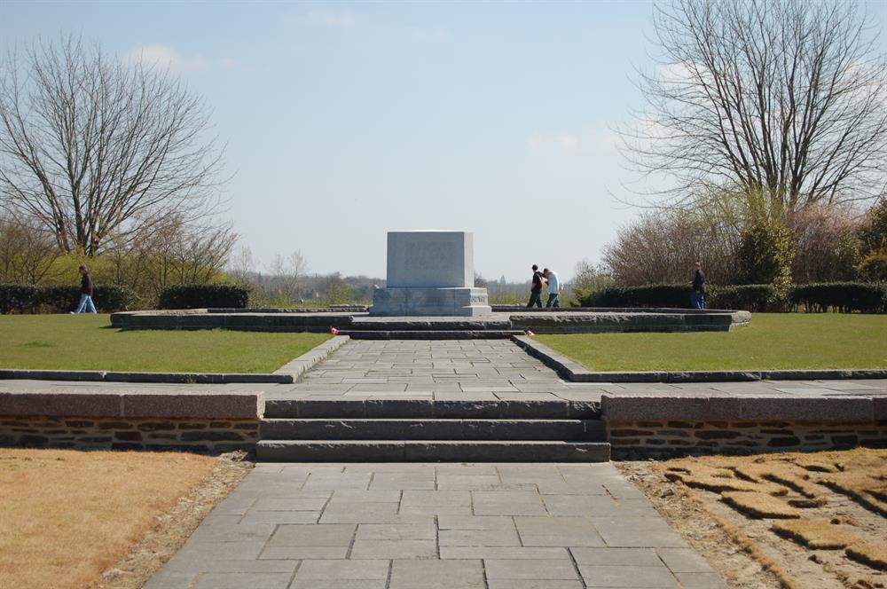
Discover the silent witnesses of the First World War with this impressive 11 km-long walk that takes you past historical war relics. You will pass by the Sanctuary Wood Cemetery, a final resting place for the brave soldiers from the Great War. As you walk over the sloping terrain, you feel the solemn atmosphere of this British military cemetery designed by Edwin Lutyens. It is a place for reflection, surrounded by nature, where 1990 heroes are commemorated.
Continue your path along a forest that was known as a refuge for soldiers during the dark years of WWI. This piece of history brings you to the Canadian memorial Hill 62, where you reflect on the courage and sacrifices of the Canadian forces. As you walk down Canadalaan, lined with maple trees that seem to whisper stories, each step takes you deeper into the story of the Battle of Mount Sorrel. Let this walk be a moment of remembrance and tribute, a path marked by peace that arose from the ashes of conflict.
automatic translation
 nodes to follow
0 km
1.5 km
1.8 km
3.1 km
3.2 km
3.4 km
4.2 km
4.2 km
5.3 km
5.9 km
6 km
6.2 km
7.7 km
8 km
8.4 km
8.6 km
8.7 km
11 km
Wednesday, January 14, 2026 by J.D.Great for walking, lots of variety in paths and very easy to walk on (concrete, earth, leaf litter). Some art to see. Construction projects from the past were explained. Lots of benches, even toilets along the way. Also lots of playgrounds (for the children). I might return for the peace and quiet.
automatic translation
Thursday, April 10, 2025 by pascal de maesschalcknice cool hike that includes a little bit of everything, very varied and very well marked
automatic translation
Tuesday, April 1, 2025 by Isabelle WtterwulgheNice walk but list of nodes is not correct. This is the correct list:69-70-71-46-45-43-30-52-32-78-31-11-12-13-48-15-26-25-24-23-69.
automatic translation
Thursday, April 10, 2025 by pascal de maesschalckthanks for the tip regarding junctions
automatic translation


 Upgrade to Premium Plus
