 Hiking
 Login
Login
 More
More
 EN
EN
 Premium
Trench walk
8.8 km • 3150 Haacht
2.3915 1 4/5
route offered by
Toerisme Haacht
 Addresse starting point (approximate)
Parking sports hall, Dijkstraat 1
 signage
The route is partially signposted with nodes. Use a GPS device or our app to follow the route.
 Description
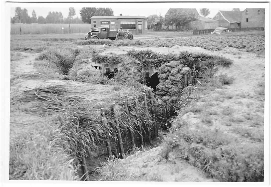
The trenches in Haachts Broek were built just before the outbreak of WWII. They are part of the KW line, which had to stop the enemy's attack. The anti-tank ditch and the bunkers are the most visible part of this.
This map offers you an overview of the paths along which you can map out a walk of your own choice. Some sections are inaccessible in wet weather.
This route is offered to you by the municipality of Haacht.
 nodes to follow
0 km
0.2 km
1.4 km
2.9 km
3.5 km
3.9 km
4.3 km
4.7 km

4.9 km
5.1 km
5.6 km
6.1 km
7.2 km
7.4 km
8 km
8.6 km
8.8 km
Saturday, April 12, 2025 by P.P.Very nice hike but only doable when preceded by a very dry period. There are boardwalks in several places, but there are still parts that cannot be crossed even with high hiking boots. The numbers of the hiking junctions on this hiking map do not correspond with the actual numbers.
automatic translation


 Upgrade to Premium Plus
