 Hiking
 Login
Login
 More
More
 EN
EN
 Premium
(H)op naar Oppem wandeling
5.7 km • Meise
 official route
2.72311 8 4.2/5
route offered by
 Addresse starting point (approximate)
Pastorie van Oppem, Processieweg 3, 1860 Oppem (Meise)
 signage
The route is fully signposted with nodes.
 Description
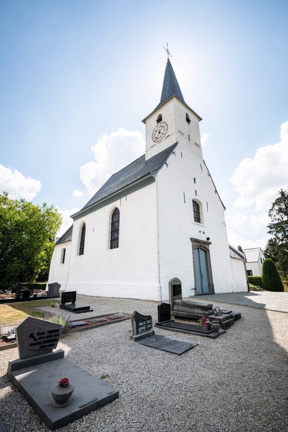
Start at the picturesque little St. Stephen's Church of Oppem for a tour through a rolling chalk landscape. Shiver with the legend of the Devil's Barn, listen to the songs of up to sixty different species of birds in the Foeksenbos and stop on the Heirbaan to enjoy the panorama in the different wind directions. On one side you can see Brussels with the Atomium and the King Baudouin Stadium, northward on a clear day you can see Mechelen's Sint-Romboutstoren and even the port of Antwerp.
This hike is offered by Regionaal Landschap Brabantse Kouters.
automatic translation
 nodes to follow
0 km
0.3 km
1 km
1.7 km
1.8 km
3.6 km
3.7 km
4.9 km
5.4 km
5.7 km
Sunday, August 20, 2023 by J.P.A pleasant, easy and well-marked green walk, perfectly guided by the app.
automatic translation
Monday, February 22, 2021 by Michel VMNice hike between Oppem and Brussegem. At junction 425 you have to pay attention, but everything is well signposted.
automatic translation
Saturday, January 16, 2021 by Guido StiensDid a combination of this walk with the Foeksenbos walk and Via Ossel walk, got to 14,5 km Nice walk, mostly unpaved, very quiet also along the paved roads. Beautiful views of Brussels, lots of variety.
automatic translation
Saturday, December 19, 2020 by A.T.Very nice walk, even though it was a dark day today. Ideal distance to get some fresh air. Quiet surroundings. Currently the trails are a bit muddy. Good signage. Definitely to do again on a sunny day with guarantee of beautiful views. Highly recommended !
automatic translation
Monday, November 30, 2020 by Cor van HasseltNice walk with quite a few unpaved paths. At junction 425 you have to be careful but we had no problems.
automatic translation
Saturday, August 15, 2020 by S.D.Fine walk that takes about 1h40 minutes (without a break). At 425 there was a "private" sign at the trailhead on the right, so I walked on and took a detour. Otherwise, the hike might have been 20 minutes shorter. Nature/asphalt surface is about 70/30. Not a flat surface in nature.
automatic translation
Sunday, July 12, 2020 by rony deroovery nice walk along small roads and avenues and also beautiful views and to node 425 no problems had as Lidia Dom explained , very well marked with 3 poles of the same node in 3 different places.
automatic translation
Saturday, December 22, 2018 by LIDIA DOMSurprisingly beautiful and varied hike so close to Brussels with regular panoramic views. Do pay attention at junction 425, there you have to follow the narrow footpath, not very clearly indicated.
automatic translation


 Upgrade to Premium Plus
