Loading...

Fort Bornem hiking trail

automatic translation

11.4 km • 2880 Bornem

Icon official route official route

11.4 km 0.0 km 0.0 km

route offered by

Badge of official route

more info

Icon starting point Addresse starting point (approximate)

Barelstraat 228, 2880 Bornem

Icon type signage of route signage

The route is fully signposted with nodes.
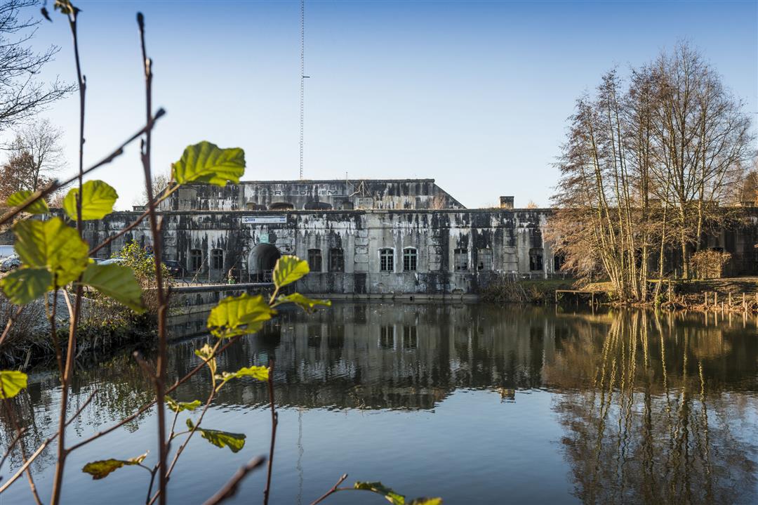
5m 5m 5m 5m
© Mie De Backer

Icon description route Description

About a tough fort, a pious abbey and bunkers in the fields during WWI. Together with the forts of Liezele and Breendonk, Fort Bornem is part of the outer belt of forts around Antwerp. The centuries-old St. Bernard Abbey was also caught up in the turmoil at the start of the war.

automatic translation

Icon nodes to follow nodes to follow

Image node 41
0 km
Image node 40
0.7 km
Image node 38
2.3 km
Image node 33
3 km
Image node 34
4.3 km
Image node 29
5.6 km
Image node 3
6.1 km
Image node 4
6.5 km
Image node 42
8.4 km
Image node 41
11.4 km
This route has 1 review(s).
Rate route!

Saturday, January 6, 2024 by M.R.Not a nice route, you constantly walk along fairly busy highways, backyards or garage boxes... little variety in landscape.
automatic translation

Which POI do you want to show on the map?

Experimental hiking network
Unsigned icon

The route you have chosen runs (partly) along an experimental virtual hiking node network (the blue-coloured nodes and sections on the map).

You must be logged in to plan routes here.

Experimental hiking network
Unsigned icon

The route you have chosen runs (partly) along an experimental virtual hiking node network (the blue-coloured nodes and sections on the map).

These routes are not controlled in the field. Before you start hiking here, take a minute to read what an experimental hiking node network is and what rules you should follow when hiking here.