 Hiking
 Login
Login
 More
More
 EN
EN
 Premium
Kapel Kouter walk
automatic translation
6.5 km • Kapelle-op-den-Bos
 official route
1.7844 5 3.1/5
route offered by
 Addresse starting point (approximate)
GC de oude pastorie, Kerkstraat 24, 1880 Nieuwenrode (Kapelle-op-den-Bos)
 signage
The route is not signposted. Use a GPS device or our app to follow the route through the virtual nodes.
 Description
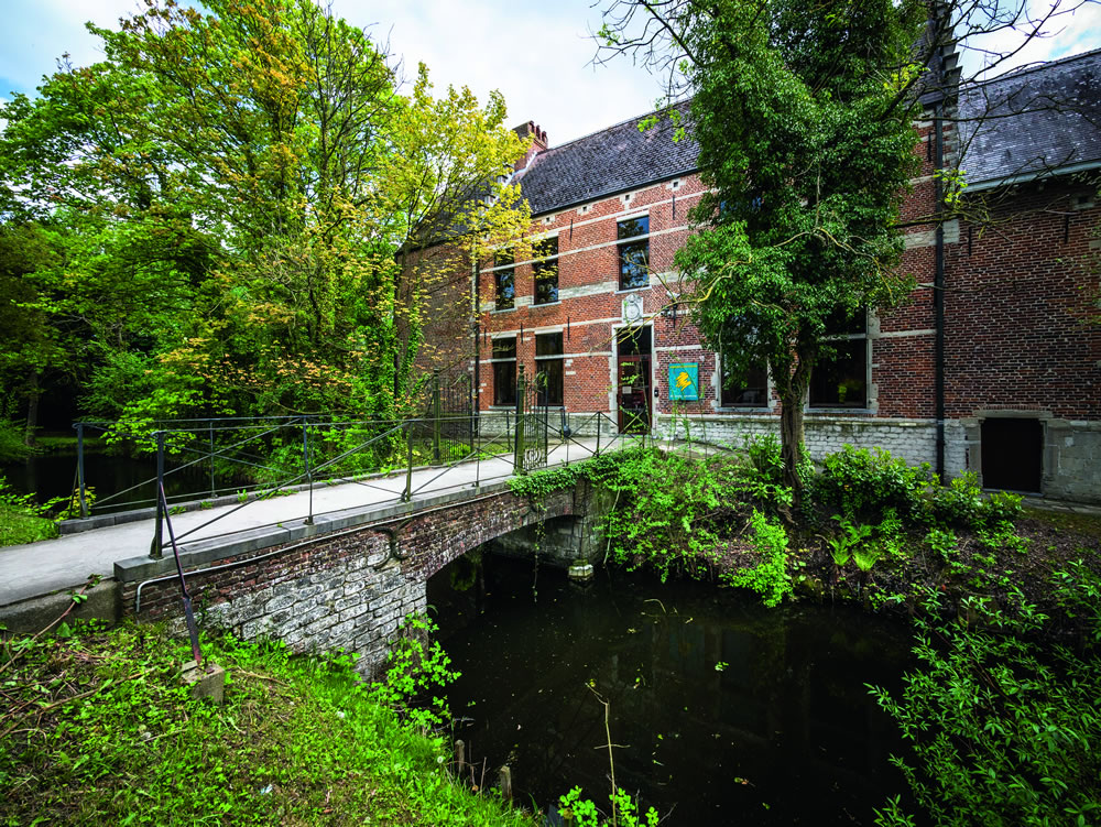
Open salt marshes and wet forests, so plenty of space and nature on this walk. First you admire the old presbytery, which was a nunnery in the Middle Ages, then a rectory and now a bustling community center. Through the fields you'll arrive at the Velaartbos, the green heart of the Birrebeek Valley. Hundreds of years old and full of rare spring blooms such as blueberry, wild garlic, wood anemone and yellow deadnettle. Natuurpunt Meise manages this nature reserve and set up the Naturally Fit Route and the Koesterburenpad for children.
NOTE: This is a hike on a virtual hiking network. The nodes are not signposted on the site.This hike is offered by Regionaal Landschap Brabantse Kouters.
automatic translation
 nodes to follow
0 km
0.4 km
1.8 km
1.9 km
4.6 km
5.3 km
6.2 km
6.5 km
Monday, April 11, 2022 by Cor van HasseltGood walk. Too bad it's a virtual junction. Some fields had been plowed, so the trail completely disappeared. In the birrebeekvalei and the velaartbos the paths were well maintained and looked after by Natuurpunt.
automatic translation
Saturday, April 17, 2021 by Eduard MaesA very nice walk among open fields and forest. Beautiful and well-kept trails. Where there might be mud, tree bark was laid or the thoroughfare was kept neat and proer by raised wooden pathways in the water. Highly recommended!
automatic translation
Saturday, November 14, 2020 by C.B.Start nice. Then left into a path where there was a lot of dog poop. Still in good spirits we continued. We came to a very narrow, muddy path with 2 levels, totally uneven. Where groups of cyclists passed by...not nice in corona time. Then even more mud. When the path to point 606 in the country was totally gone, we turned around.
automatic translation
Friday, November 6, 2020 by Canters FrankBeautiful hike on mostly unpaved paths. Especially the second part of the hike through the Velaertbos and back to Nieuwenrode is worthwhile. Only disadvantage is that the Lange Zijp (footpath) has completely disappeared and you have to navigate on GPS right through a field, which is very muddy and difficult to step on after plowing in autumn.
automatic translation
Wednesday, January 30, 2019 by L.V.Am novice user of "hiking node". This hike is pleasant to do and most of the hike you move among the fields. Using the app is a must because there are no arrows anywhere indicating the route. On wetter days, wear suitable footwear because there can be a lot of mud along the way,
automatic translation


 Upgrade to Premium Plus
