 Hiking
 Login
Login
 More
More
 EN
EN
 Premium
The Broskens - valley of t Merkske
automatic translation
8.5 km • Baarle
4.0589 6 4/5
route offered by
Toerisme Provincie Antwerpen
 Addresse starting point (approximate)
knooppunt 22 aan de kerk van Zondereigen
 signage
The route is fully signposted with nodes.
 Description
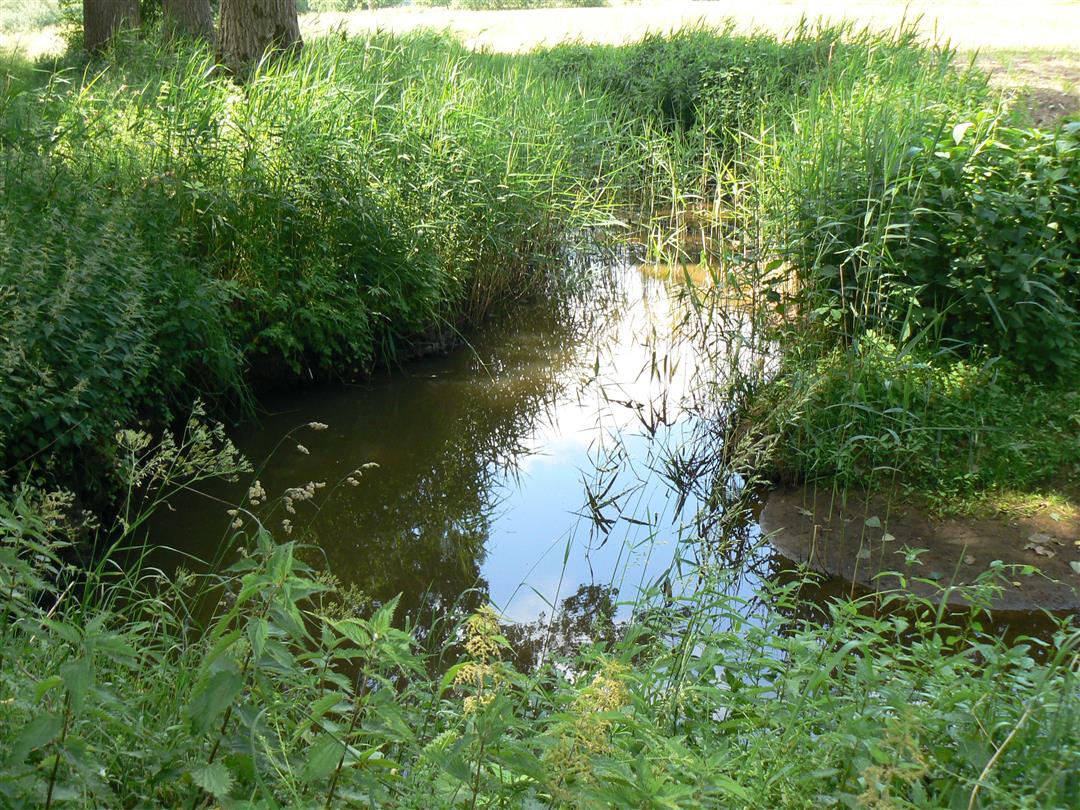
Small-scale landscape with pools, wood edges and meadows. The Merkske, a tributary of the Mark, is an authentically meandering stream. It forms the natural border between the Netherlands and Belgium and between the Noorderkempen and North Brabant. Wooded hedges and bramble walls, flowery meadows, pools, heath-rich grasslands and lots of black alders, which love to stand with their feet in the water, adorn the landscape. The Agency for Nature and Forests, Natuurpunt and Staatsbosbeheer, guarantee more than 1,900 hectares of exceptional nature and landscape here.
automatic translation
 nodes to follow
0 km
0.1 km
0.5 km
1.3 km
1.5 km
2.3 km
3.5 km
3.6 km
4.1 km
5.1 km
5.7 km
5.7 km
6.1 km
6.3 km
7.5 km
7.5 km
8.4 km
8.5 km
Wednesday, July 22, 2026 by L.B.t Merkseke is a beautiful, peaceful estate. Some of the signposts with arrows are missing, so you’ll need to keep the map handy. In Belgium, the signs are red and white, and in the Netherlands, they’re yellow and green.
automatic translation
Sunday, July 5, 2026 by Rob Van BaalA lovely route, with lots of bird sounds. It's handy to keep the app open while you're out.
automatic translation
Wednesday, February 4, 2026 by Thierry MasureIt doesn't get any better than this
automatic translation
Wednesday, December 31, 2025 by V.E.Beautiful route through natural landscape, first bit along road, afterwards more than compensated by rest of the route. Highly recommended!!! Tip for the disappointed first reviewer, use the hiking app and download the route as gpx on an additional hiking app. Bet you will find your way then ? # Never stop exploring.
automatic translation
Sunday, September 28, 2025 by Emily MertensWell marked - beautiful nature and no human to be seen.
automatic translation
Sunday, June 15, 2025 by L.A.What seemed like a promising hike was a letdown. It went well up to junction 23 in Belgium, didn't find junction 53 in the Netherlands, walked the whole time along a busy road with lots of traffic and retraced our steps.
automatic translation


 Upgrade to Premium Plus
