 Biking
 Login
Login
 More
More
 EN
EN
 Premium
Hoproute
38.7 km • Affligem
 official route
5.0609 6 2.9/5
route offered by
 Addresse starting point (approximate)
Abdij van Affligem, Abdijstraat 6, 1790 Affligem
 signage
The route is fully signposted with nodes.
 Description
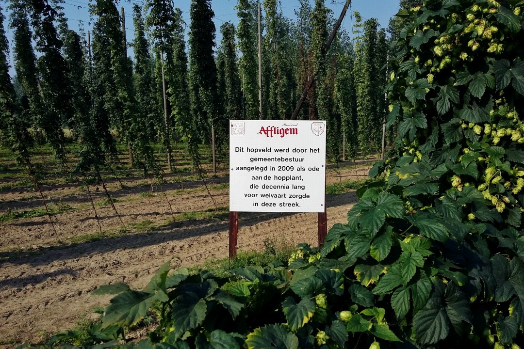
From the impressive Affligem Abbey, you pedal through a rolling stretch of greenery of the Brabant Kouters just a sigh from Brussels. You pass through what for centuries was one of the richest hop regions in Europe. You cycle past the artful hop field of Asse and follow the edge of the Kravaal forest. On the market square of Asse it is time for a break. There you stand face to face with the Hopduvel.
automatic translation
 nodes to follow
0 km
3.6 km
4.2 km
5.9 km
7.5 km
10.2 km
11.2 km
12.2 km
15.8 km
17.6 km
18.5 km
20.4 km
26.2 km
30.8 km
34.3 km
36.5 km
37.1 km
38.6 km
Thursday, August 6, 2020 by H.V.Today we went cycling away from home.We are very disappointed with this trail , cobblestone roads, gravel roads and many villas and no sights . This hopper route is not worth its name , only one field seen . Parts of this route can be used for mountain biking .
automatic translation
Sunday, July 26, 2020 by M.D.Pebble lanes, cobblestones, slippery narrow lanes. There are much nicer routes than this.
automatic translation
Sunday, October 7, 2018 by F.C.A few, but only a few nice pictures. Too many allotment roads and busy highways. This region could be better!
Download seemed more reliable to us than the junction series. Kudos for the clear indication of the detour to node 9.
automatic translation
Friday, October 5, 2018 by Ted WoestenborghsAlready quite hilly with sometimes difficult roads but you.get beautiful pictures in return
1 hopfield seen
automatic translation
Thursday, April 27, 2017 by J.R.Beautiful route, beautiful scenery and very quiet places discovered. Do recommend with sturdy bike for some unpaved roads.
We rode the tour with a tandem mtb. So no problem for us . We thought it was successful!
automatic translation
Tuesday, November 1, 2016 by H.V.Nice little roads. Nice route with some terraces.
Still a total of about three kilometers of cobblestones and dirt roads.
Not recommended during or after rainy weather.
automatic translation


 Upgrade to Premium Plus
