 Biking
 Login
Login
 More
More
 EN
EN
 Premium
Pasture Route
automatic translation
54.7 km • Wuustwezel
3.6106 4 4/5
route offered by
Toerisme Provincie Antwerpen
 Addresse starting point (approximate)
kp 92, Bruidsweg 1, 2990 Wuustwezel
 signage
The route is fully signposted with nodes.
 Description
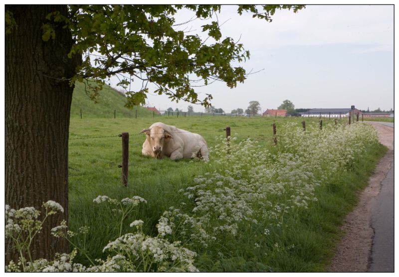
Wuustwezel is by far one of the rural municipalities of the Antwerp Kempen. The Weilandroute bicycle loop is a fine illustration of this. The landscape through which you cycle is one of vast fields and meadows, historic farms, grazing cows and large vegetable patches. On the horizon you always see forests, lots of forests. And above all, there is the pleasant tranquility of the Kempen countryside. The Meadows Route crosses Wuustwezel and the borough of Loenhout.
automatic translation
 nodes to follow
0 km
1.2 km
6.3 km
9.3 km
13.5 km
17.3 km
20.3 km
21.5 km
25.5 km
25.9 km
28 km
31 km
33.7 km
34.9 km
42 km
44.2 km
47.1 km
47.7 km
49.6 km
52.1 km
53.2 km
53.4 km
54.7 km
Wednesday, September 7, 2022 by Vera Van Hoof - TheysCycled this route with a strong wind. We did encounter some benches, 1 single bench with table. 3 Drinking places (for sanitary stop and et cetera) The Napoleonshoeve / Schalienhuis and Den Heibaard (which is ne fish pond). You do have to cross several busy lanes, for the rest beautiful meadows / wide bicycle roads.
automatic translation
Thursday, May 26, 2022 by Lieve WillemsHalokes , this route lives up to its name . From start to finish fields , meadows beautiful quiet roads . Do take a pick nick .no hospitality or store to be seen . But strawberry vending machines . Enjoy it
automatic translation
Thursday, March 26, 2020 by C.Z.Good cycling route of 54 km but sensitive to (head) wind. Bike lanes are also very often absent but very quiet roads everywhere so little problem. The presence of large agricultural vehicles is a fair comment.
Unfortunately one flaw in the course of the junctions mentioned above ; after the second '96' junction 79 has to be followed after which 93.
So in the sequence of all junctions we get the following sequence : 97 - 96 - 96 - 79 - 93 - 93
automatic translation
Tuesday, February 21, 2017 by A.G.Lovely bike route between modern farms and pastures. Fine bike paths everywhere, but keep an eye out for agricultural vehicles. The route is easy to shorten between node 90 and 93.
automatic translation


 Upgrade to Premium Plus
