 Biking
 Login
Login More
More EN
EN Premium
Bruegelroute
38.7 km • Dilbeek
 official route
1.6120 18 3/5
route offered by
 Addresse starting point (approximate)
CC Westrand, Kamerijklaan 46, 1700 Dilbeek
 signage
The route is fully signposted with nodes.
 Description
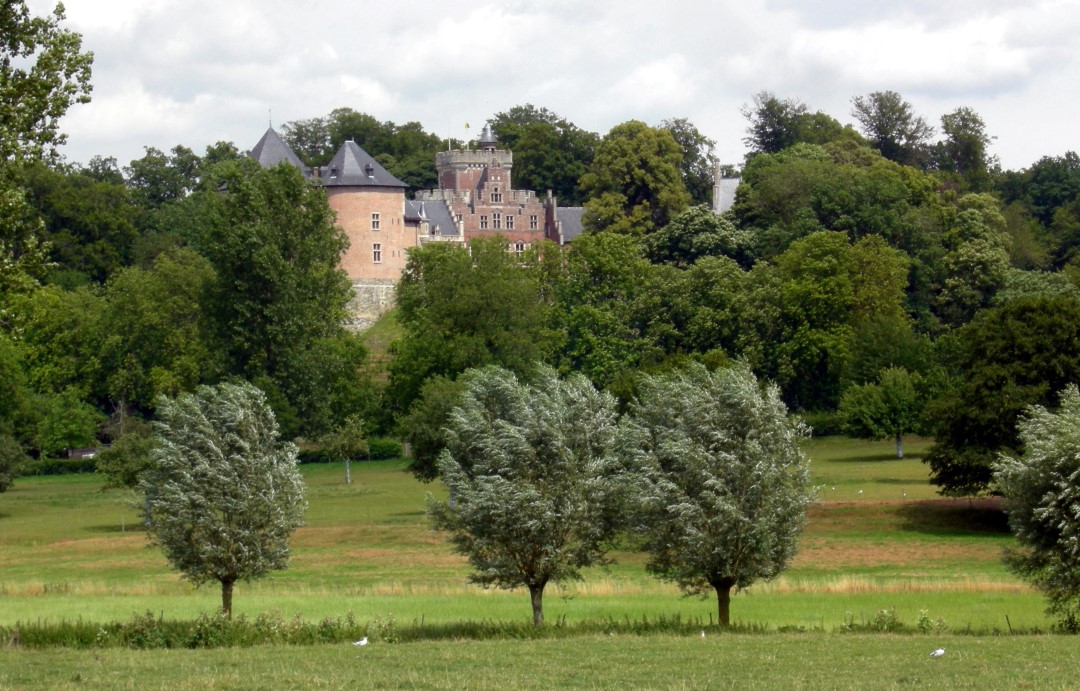
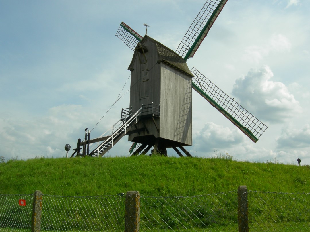
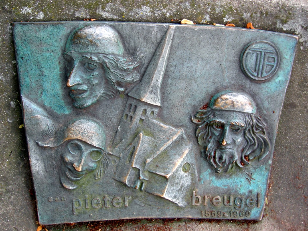
Pieter Bruegel the Elder left his mark on this route. From the center of Dilbeek you cycle to the little church of Sint-Anna-Pede , the start of the Bruegel walk that takes you past reproductions of Bruegel's finest paintings in this Open Air Museum. The landscapes of the Pede Valley were a source of inspiration for the painter.
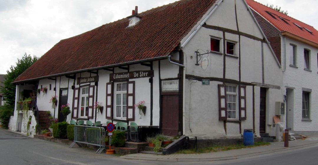
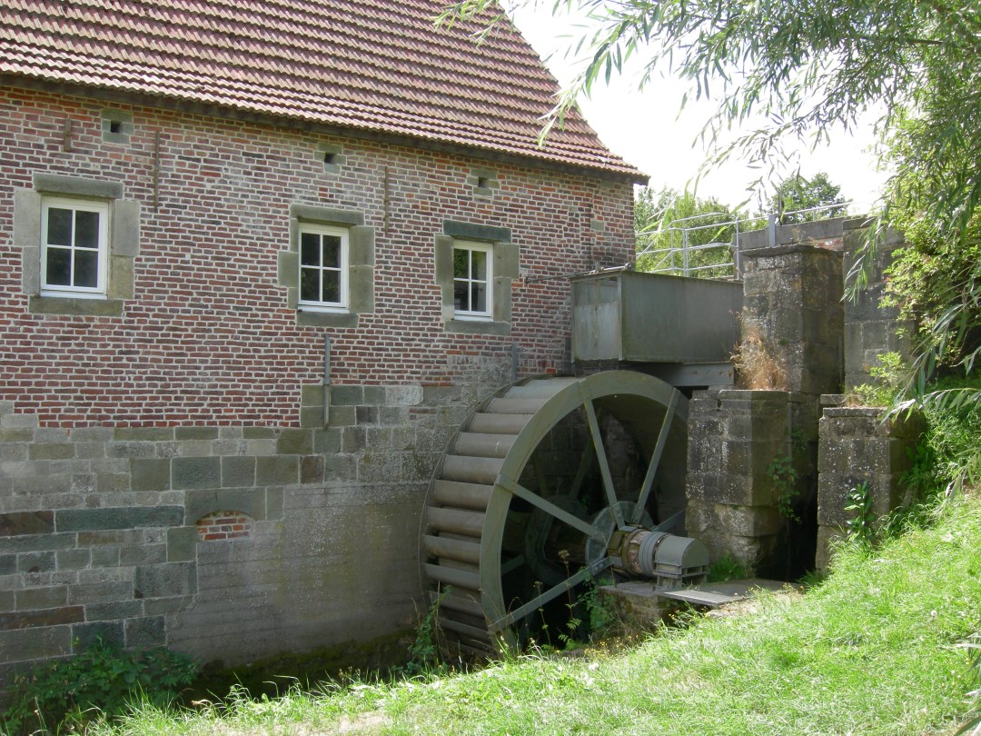
But also the green domains of Coloma in Sint-Pieters-Leeuw, the Castle of Gaasbeek and Groenenberg are on your way. The water mill of Sint-Gertrudis-Pede invites you for a rest. After a bike ride, a kriek, geuze or lambic from the region can taste good.
This route is offered by Tourism Flemish Brabant.
automatic translation
 nodes to follow
0 km
3.9 km
5.8 km
8.6 km
10.9 km
13.5 km
14.2 km
15.3 km
17.6 km
17.6 km
17.6 km
19.2 km
22.2 km
22.4 km
25.5 km
27 km
31.2 km
31.2 km
31.2 km
32.6 km
34 km
35.2 km
37.8 km
38.6 km
Monday, July 8, 2024 by E.B.I don't think anything about it yet, had planned them, but when I read the reviews...Can someone give another update, because the last review is dated. EVEN BETTER WOULD BE FOR THE ORGANIZATION TO INDICATE HERE THAT THEY HAVE THEIR AFFAIRS IN ORDER BY NOW/ WE DO PAY FOR THIS!
automatic translation
Tuesday, July 21, 2020 by R.V.Dear people, please report it here please ! => https://www.toerismevlaamsbrabant.be/info/Routemeldpunt/
automatic translation
Tuesday, July 21, 2020 by R.V.continued 3 : 2) St anna Pede : at the end of Koeivijverstraat No sign ! ....(left, right or straight on ? Again wasting time, cursing & stressing), in fact it's right, in Appelboomstraat !
DO SOMETHING ABOUT IT !
automatic translation
Tuesday, July 21, 2020 by R.V.continued ...for this Brueghel route, and today 21.07.2020 it still is ! ! ! Now who is responsible for this ? Where are the signs missing ? => 1)in Dilbeek :at the end of the Bruinelieveheerstraat (is it straight on ? left, right ? start figuring it out ! )in fact it is right, follow the Langeveldstraat.see continuation
automatic translation
Tuesday, July 21, 2020 by R.V.Have ridden this one ! It is beyond comprehension : every time I follow a bike route now I find that signs are missing, whether they are arrows on the moutainbike routes, or recreational routes....tis almost the same everywhere : negligence, a generalized "I don't care" attitude. I read date several people have now denounced this
automatic translation
Sunday, May 17, 2020 by daniel WandelsI drove this route too and unfortunately I didn't write anything down but there are some signs missing and you can't drive this route properly, it's URGENT that something be done about it, and not only on this route but on other routes there are signs missing too. 👎🏻
automatic translation
Sunday, May 10, 2020 by Peter Vanden DriesscheBeautiful and varied cycling route for the athletic amateur. Done with wife and son during the corona crisis as an alternative excursion and this was not too bad. A picnic in the beautiful and sunny weather in early April was unfortunately not allowed.
automatic translation
Saturday, July 13, 2019 by en Jasmina Stijn Wonderful route to explore the region. Ridden with course bike and gravel bike. For the course bike, some hiking trails (gravel/sand) were not ideal.
Did the route with GPS, so we can't say anything about signposting.
Too few altimeters to call this "the Tuscany of the North" ;)
automatic translation
Tuesday, May 28, 2019 by Marc BeckersDear, I cycled part of this route yesterday and wanted to say something. I started the route near my home on the Wolsemstraat in Dilbeek. The route is pretty nice although I lost my way once between Oudenaken and St. Pieters-Leeuw where I missed a sign (or maybe it was just missing ?) so I ended up on the Pepingsesteenweg and rode to St. Pieters-Leeuw where I got back on the route at the church. Also in the center of Schepdaal I think there was a problem with the signage.
I did the route with a road bike and on 32 pieces the route sent me on a piece that was not suitable for it :
1. the part of the Groenstraat between the Brusselstraat in Lennik and the Kasteelstraat in Gaasbeek.
2. the Elsweg in St. Pieters-Leeuw of which a part is really a walking route and not a bicycle route.
3. the Puttenberg and the part after that to get to the Klein Nederstraat in Vlezenbeek.
I still don't understand why I didn't get a flat anywhere. For me, these are "missing links" that really need to be fixed.
Other than that, I really enjoyed the ride. Soon I expect to add the rest of the route as well.
automatic translation
Monday, April 22, 2019 by Jeanine ChabertSo sorry , so bad , not understandable , that so many signs are gone or wrong .
Such a beautiful route and beautiful region.
We got lost several times and also did not do parts of the route.
Can you please do something about it?
Jeanine C
automatic translation
Saturday, April 20, 2019 by C.C.From 20 km road works and signs just gone....
automatic translation
Sunday, February 24, 2019 by M.W.Found it a very nice route. occasionally not super clearly marked but very nice (especially the second part)
automatic translation
Tuesday, August 14, 2018 by Veerle GunsFine and varied route. Poor signage though, poorly placed and sometimes missing. So plan extra time to take a few wrong turns.
automatic translation
Thursday, May 10, 2018 by M.S.Bicycle route ridden on Ascension Day and it must be said that I did not find it a very relaxing experience. Heavy traffic, too many cars especially in the Schepdaal / Itterbeek area.
automatic translation
Monday, November 13, 2017 by M.D.Not recommended for road bikes and not recommended with narrow tires with or after rainy weather. Had two punctures today and could not finish my race. Soon I will try again but with my mountain bike.
The signage seems fine to me. On the part I rode, all the signs seemed new to me.
automatic translation
Thursday, November 3, 2016 by P.V.The signage is not always clear. After getting lost twice (in St-Pieters-Leeuw/Zuun), and returning to the last sign I saw, I stopped. The first time I guessed to turn into a street, and this turned out to be correct. The second time, unfortunately, I didn't find the sign again, so I made a little bike ride of my own, following my nose....
automatic translation
Thursday, August 18, 2016 by L.T.Regular dismounting is definitely recommended, especially for those who do not really have the climbing legs: one hill follows another! Not insurmountable and doable on a normal bike, but you will feel it...
Bikes with sensitive tires are better left at home: several times you ride on pure field roads, gravel, gravel, cobblestones ...
automatic translation
Thursday, August 18, 2016 by L.T.The signage is quite easy to follow. The signs are rather weathered, on most of them the text is almost completely worn away but the direction arrow and usually the name 'Bruegelroute' have been newly pasted on. We got the impression that the trail is well maintained and that any defects will be fixed as soon as they are reported. Of course, it is always smartest not to depend entirely on the signs and to have a map or GPS track at hand.
automatic translation


 Upgrade to Premium Plus
