 Biking
 Login
Login
 More
More
 EN
EN
 Premium
Beyond Lakes and Channels
automatic translation
41.1 km • 2480 Dessel in de provincie Antwerpen
 official route
3.0508 0 0/5
route offered by
 Addresse starting point (approximate)
Sas4 Toren Nieuwedijk 72 Z
 signage
The route is fully signposted with nodes.
 Description
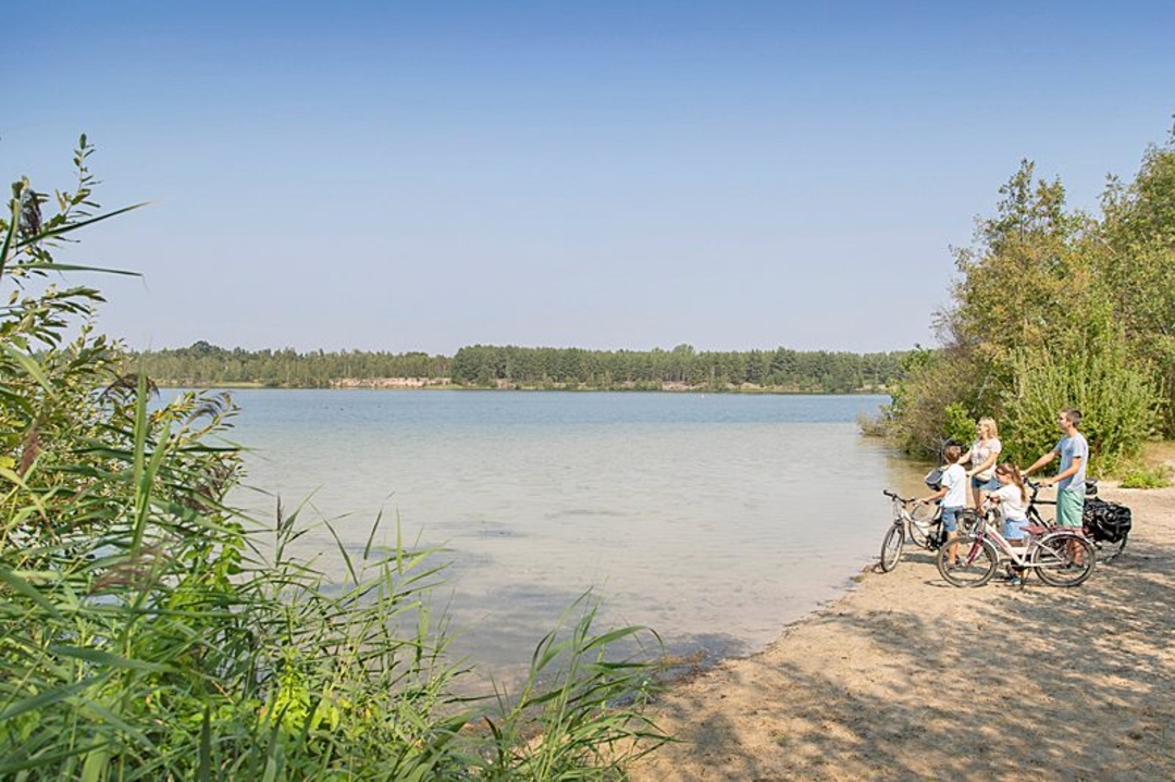
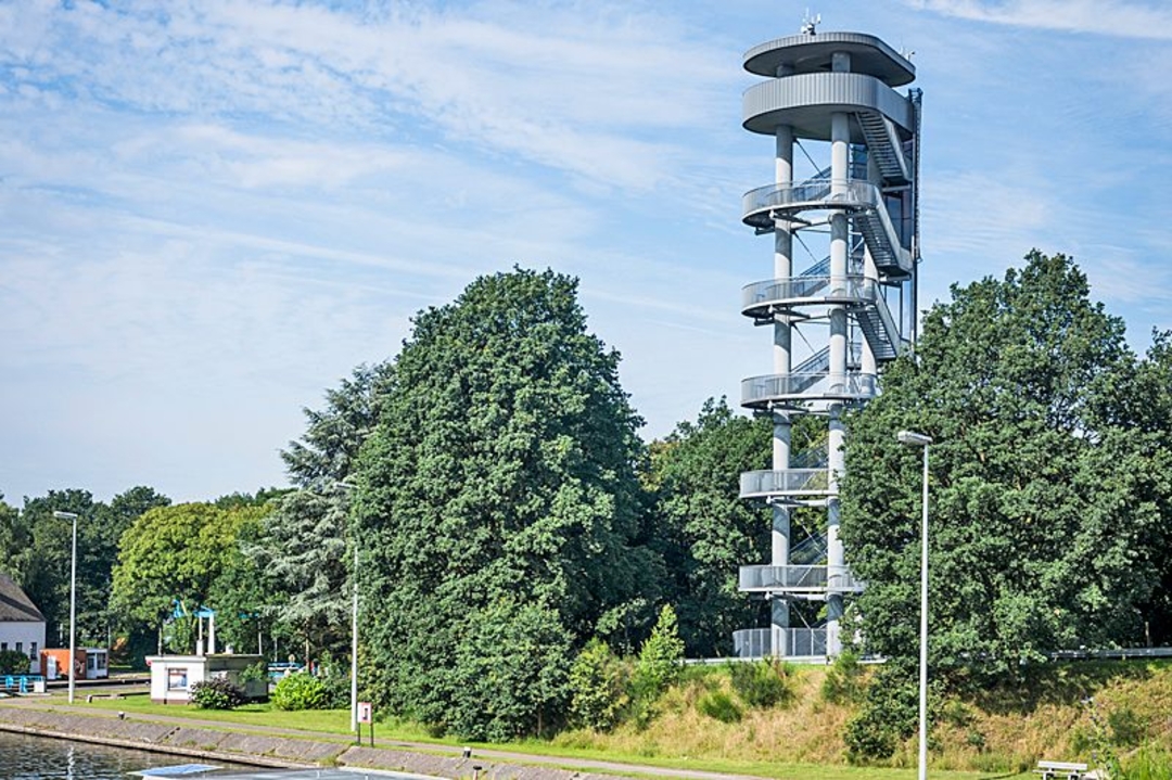
From the Molse Nete to vast silver lakes. From centuries-old water mills to a hip marina. Dive into the Kempen for this watery trip. Start in style at the Sas4-Tower, at a crossroads of three (!) canals.
Location: Dessel and Mol
eye-catchers:
Sas 4-Tower, Bailey Bridge, Quartz Experience, Ecocentrum De Goren, Zilvermeerhaven Port Aventura,
Provincial Recreation Area Zilvermeer, Watermill on Molse Nete and Mill of Ezaart, Fifteen chapels and Tabloo.
highly recommended: at the top of the Sas4 Tower you can enjoy a breathtaking panorama, at the bottom of the visitor center you can discover fascinating stories about the water-rich landscape barrier-free: Zilvermeer with, among other things, 100% accessible vacation homes and wheelchair-friendly water playground and wheelchair sailing in Port Aventura
Instagram: Port Aventura marina
picnic: Ecocentre De Goren and Fifteen Chapels
child-friendly: play forest 'Dollemollenbos' at Ecocentrum De Goren and Zilvermeer
accommodation: Zilvermeer Campsite (various formulas, including new Tiny Vlot) and Sunparks Kempense Meren
reca: Port Aventura café
automatic translation
 nodes to follow
0 km
0.3 km
2 km
4.7 km
4.8 km
4.8 km
7.7 km
12 km
15.2 km
15.4 km
15.5 km
16 km
19 km
19.4 km
23.2 km
28.6 km
31.2 km
35.8 km
40.7 km
40.8 km
41.1 km


 Upgrade to Premium Plus
