 Biking
 Login
Login
 More
More
 EN
EN
 Premium
Markroute
42.2 km • Pajottegem
 official route
4.38214 9 4.2/5
route offered by
 Addresse starting point (approximate)
Parking gemeentehuis, Centrum, 1540 Herne
 signage
The route is fully signposted with nodes.
 Description
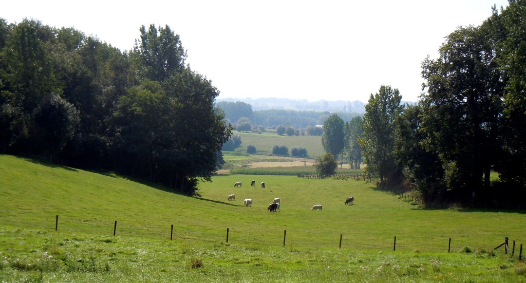
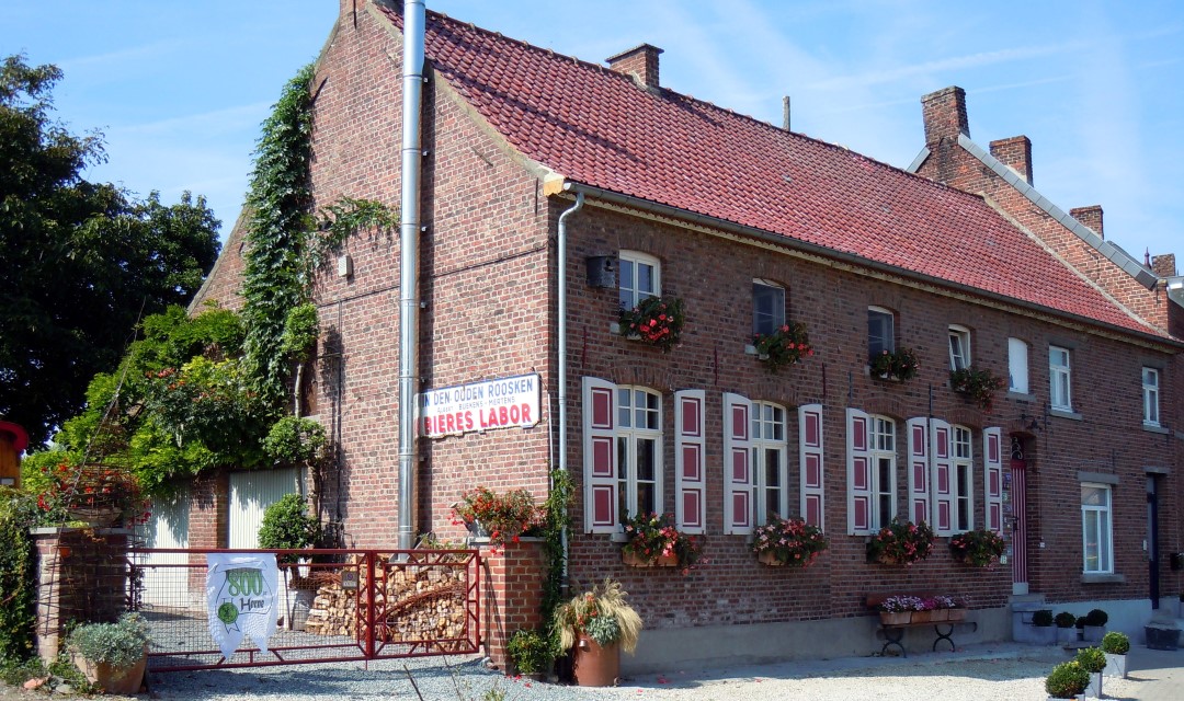
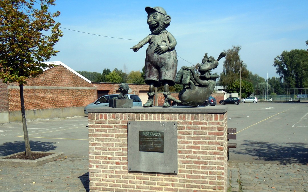
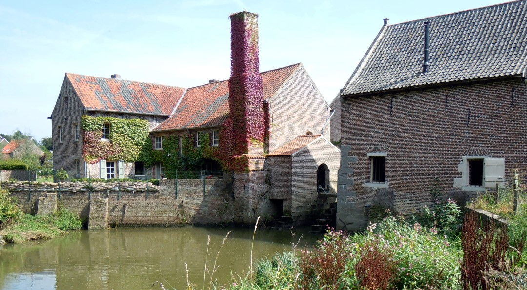
A bike ride through the vast landscape of the farthest tip of the Pajottenland, following the Mark River. You’ll pass water mills, farmhouses, churches, and chapels. As you climb the Congoberg, you can admire Koenraad Tinel’s sculpture “The Abduction of Europa.” And be sure to stop for a moment at the statue of Urbanus or at the Baljuwtuin in Galmaarden.
automatic translation
 nodes to follow
0 km
1 km
3.8 km
3.8 km
8.1 km
9.8 km
10.1 km
13.4 km
14.6 km
19.2 km
19.9 km
24.5 km
27.5 km
33.2 km
33.9 km
35.9 km
39.1 km
39.3 km
41.7 km
42.1 km
Friday, August 15, 2025 by M.A.Very nice route...
automatic translation
Wednesday, October 8, 2025 by kevin blommaertAre all node points properly marked ?
automatic translation
Saturday, July 12, 2025 by Haroun SouirjiNice route with mostly countryside roads with very few cars. 100% paved. a couple of a bars and restaurants on the way too. Nice alternation of angles of moderate difficulty.
Wednesday, August 10, 2022 by Philippe MetelmannNice route. Signage is definitely in order at the moment (route done on 10/08/2022). Encountered plenty of bistros along the way.
automatic translation
Tuesday, April 27, 2021 by P.R.Beautiful scenery, very quiet roads. Much more pleasant driving than along rivers where crowding has increased a lot lately. All signs were present and well visible. And highly recommended!
automatic translation
Monday, November 4, 2019 by Martine NEIRINCKXHighly recommended, beautiful scenery and roads. It was a super trip . Best to bring drinks because it is dry along the way.
automatic translation
Sunday, September 15, 2019 by B.D.Signage may need to be revisited/renewed.
Not clear everywhere.
At the end a lot of 'toerkes'.
Very beautiful surroundings.
automatic translation
Friday, May 25, 2018 by F.V.Beautiful route but not rideable without GPS. Numerous signs are missing.
With GPS however a super ride. Hilly and sometimes tough but for an experienced cyclist and especially with an e-bike certainly doable.
Not many places to drink along the way so it is best to take some liquid provisions with you. It is recommended to stop every now and then to contemplate the surroundings.
automatic translation
Thursday, May 11, 2017 by L.D.Indeed, as a previous cyclist pointed out, a very nice cycling route, slightly undulating on quiet roads. Signage on the descent of the congoberg is no longer there. Just that signs Signs should be cleaned once.
Gr, ldh
automatic translation
Sunday, April 9, 2017 by J.D.very nice bike route , to start the cycling year , quiet roads ideal .
One minus point the signs are not clear,
should be cleaned .......
with the GPX was OK
Greetings José
PS ; will add three more pictures
automatic translation


 Upgrade to Premium Plus
