 Biking
 Login
Login
 More
More
 EN
EN
 Premium
Valley of the Mollignée, Dinant and a lot of Ardennes
automatic translation
63.8 km • Anhée
7.21610 1 5/5

 Addresse starting point (approximate)
RAVeL L150, 5537 Denée, BE
 signage
The route is fully signposted with nodes.
 Description
Departure point: parking Drumont in Maredret.
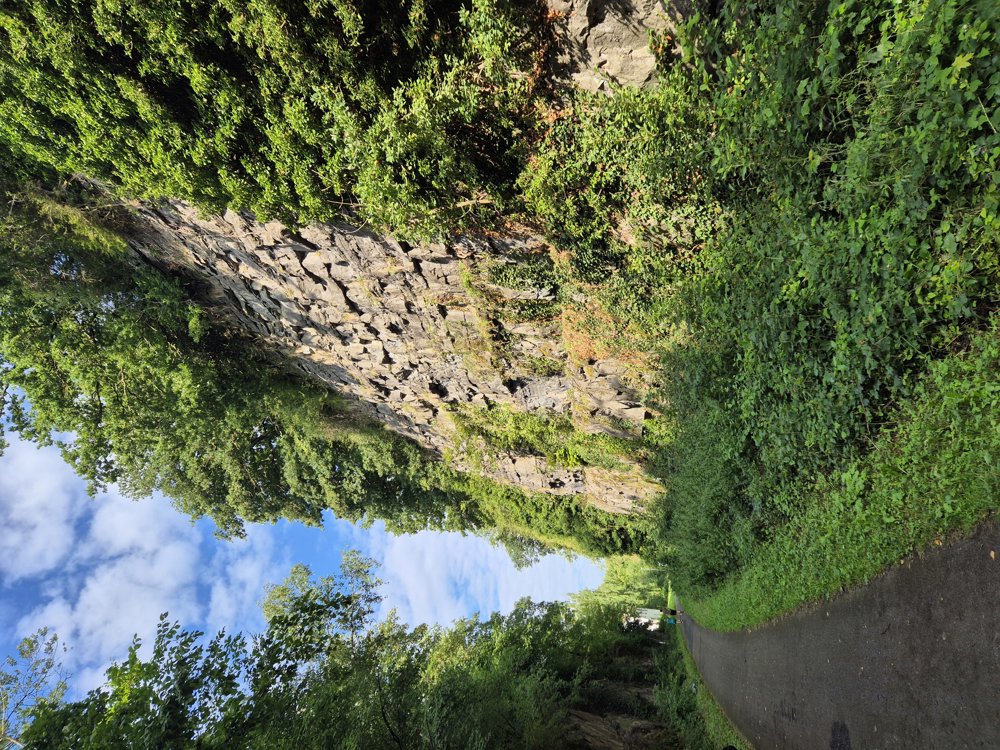
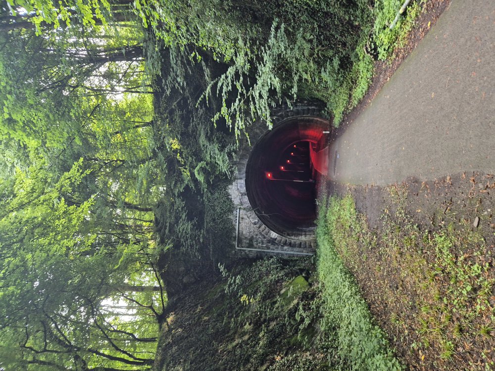
Crossing a bridge, you enter RAVeL 150, emerging from the Molignée valley, a bike path from Aisemont to the Meuse in Anhée. Meanwhile, we pass through a very long railway tunnel and follow the route of the railbike of Maredsous, and we can turn towards the Abbey of Maredsous.
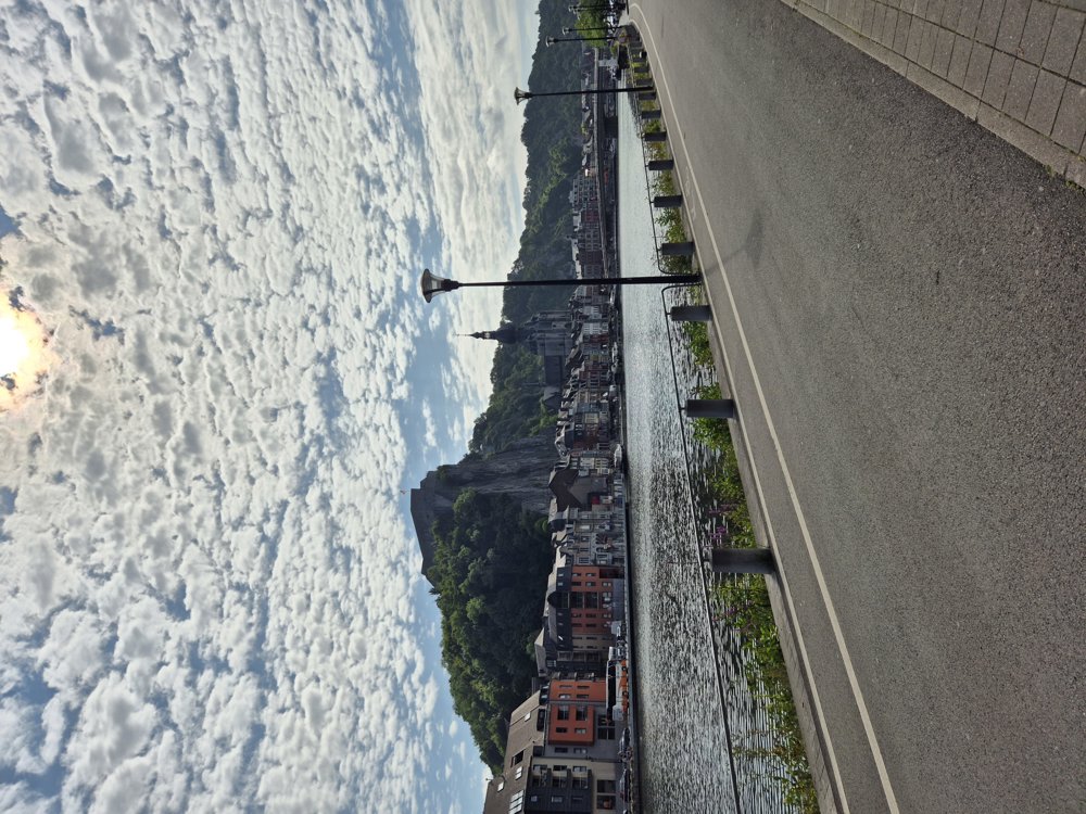
In Anhée, we follow the Meuse past Dinant. There, we cycle away from the Meuse and start our first serious climb. We climb and descend for the next 23 km, enjoying the beautiful views!
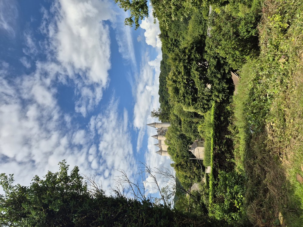
In Celles, we pass a very well-preserved and visitable castle of Vêves. Celles itself is also a very beautiful village.
From junction 39 to 38, you cycle along a very beautiful road, along the mountain slopes, wooded with not too many climbs and descents, and thus return to Dinant. In Dinant, we recharge with its many horeca establishments and sights.
The last stretch of cycling is up and down through field and forest until Sosoye, also a very beautiful village. Then last climb...
automatic translation
 nodes to follow
0 km
3 km
4.5 km
8.4 km
10.8 km
11.7 km
11.8 km
12 km
13.2 km
17.2 km
18 km
18.2 km
18.5 km
19.1 km
19.4 km
19.7 km
21.9 km
28.1 km
30.4 km
41.2 km
48.6 km
49.4 km
54.4 km
55.4 km
58.5 km
58.7 km
60.6 km
60.8 km
60.8 km
60.8 km
63.5 km
63.8 km


 Upgrade to Premium Plus
