 Biking
 Login
Login
 More
More
 EN
EN
 Premium
Art trails discovery loop
automatic translation
86.2 km • Ciney
 official route
3900 0 0/5
 Addresse starting point (approximate)
Place Monseu 5590 Ciney Belgique
 signage
The route is fully signposted with nodes.
 Description
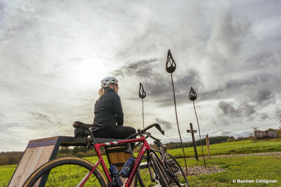
82.9 km of art and nature in the heart of Condroz-Famenne
Starting from Place Monseu in Ciney, set off on an 82.9 km loop through the rolling Condroz countryside, discovering more than a dozen works of Land Art installed along the Sentiers d'Art en Condroz-Famenne.
A unique itinerary, signposted via the points-nœuds network, combining nature, art and contemplation.
Along the way, admire "Bal'art" and "Fondu" near point A, the forest installations "Touch of Infinity" (B) or "Torvtak" (C), the poetic "Concert d'oiseaux" and "L'Arbre mobile" (D), or "Companion", "Capteurs de rêves" and "Macro-processor" at various points along the loop.
The Sawhis park (L) invites you to take a picnic break between "Aéropiano" and "Marche de l'évolution", while creations such as "Cloud Tree" (H) and "Positive Pattern" (J) punctuate the journey with suspended moments.
This cycling route is an invitation to slow down, observe and enjoy an immersive experience between contemporary art and natural heritage.
A truly open-air museum, in the heart of the countryside, for an unforgettable day out.
automatic translation
 nodes to follow
0 km
4.6 km
9.6 km
9.6 km
13.2 km
13.5 km
18.9 km
21.1 km
21.9 km
28 km
30 km
33.8 km
34.6 km
37.9 km
39.7 km
44.2 km
44.7 km
50.3 km
52.6 km
54.7 km
57.1 km
57.2 km
61.2 km
63.2 km
65.2 km
68.2 km
72.6 km
78.3 km
80.2 km
84.5 km
85.3 km
85.6 km
85.7 km
85.8 km
85.9 km
86.1 km
86.2 km


 Upgrade to Premium Plus
