 Biking
 Login
Login
 More
More
 EN
EN
 Premium
Through the Hatertse and Overasseltse Fens
automatic translation
49.2 km • Mook en Middelaar
5.7393 0 0/5

 Addresse starting point (approximate)
Oosterkanaaldijk, 6582 AD Heumen, NL
 signage
The route is fully signposted with nodes.
 Description
We depart from junction 50 in Limburg and shortly thereafter cross the Meuse into North Brabant.
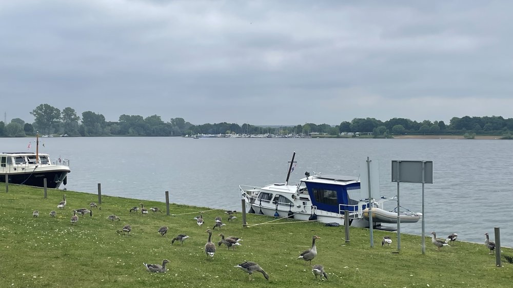
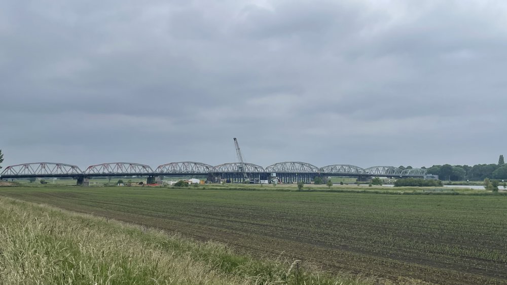
Via the Kraaijenbergse Plassen, we reach the fortified town of Grave. Upon leaving the town, we cross the impressive John S. Thompson Bridge and enter Gelderland.
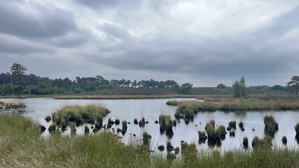
The route continues towards the Hatertse and Overasseltse Vennen, a diverse natural area with ponds, river dunes, heathland, and forests. Via the Staddijk and the neighborhoods of Weezenhof and Hatert, we reach the forest area of Heumensoord.
On beautiful cycle paths, we ride to the gliding field of the Nijmegen Aeroclub, where a break is possible. We then follow the cycle path along the Limburg-Gelderland provincial border towards the Mookerheide.
Through this hilly natural area, we cycle past the Jachtslot to Molenhoek. Through the village center, we return to junction 50, the endpoint of this varied route.
automatic translation
 nodes to follow
0 km
0.5 km
0.6 km
1.4 km
4 km
4.4 km
4.6 km
9.2 km
12.8 km
12.8 km
13.4 km
14.9 km
15.7 km
17 km
18.4 km
19.6 km
20.1 km
21.4 km
22.4 km
24 km
25.2 km
25.3 km
25.4 km
28.3 km
29.7 km
30.5 km
31.9 km
32 km
34.1 km
34.2 km
34.3 km
34.8 km
36 km
37.9 km
40.2 km
43.2 km
43.3 km
44.6 km
44.7 km
45.4 km
45.9 km
45.9 km
45.9 km
47.3 km
47.5 km
49.2 km


 Upgrade to Premium Plus
