 Biking
 Login
Login
 More
More
 EN
EN
 Premium
Cycling between the Mine Heaps
automatic translation
60.6 km • Maasmechelen
8.09620 0 0/5

 Addresse starting point (approximate)
Vrijthof 17, 3630 Maasmechelen, BE
 signage
The route is partially signposted with nodes. Use a GPS device or our app to follow the route.
 Description
From the Vrijthof in Eisden, we cycle to junction 50, then northwards along the River Maas and Oude Maas towards Stokkem.
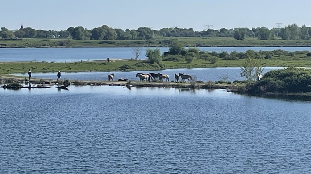
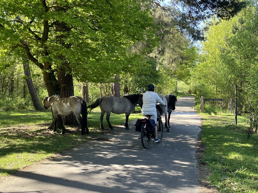
Just past the De Wissen nature reserve, we turn at junction 49 towards Dilsen. The route then follows a stretch of the Zuid-Willemsvaart canal to Bergerven, where horses roam freely through the area and sometimes across the cycle path.
Via a wooded trail, we reach Opoeteren and then cycle through the Gruitroderbos and over the Ophovenerheide to Opglabbeek. We continue our journey through the nature of the Heiderbos to As station, where a terrace stop is possible.
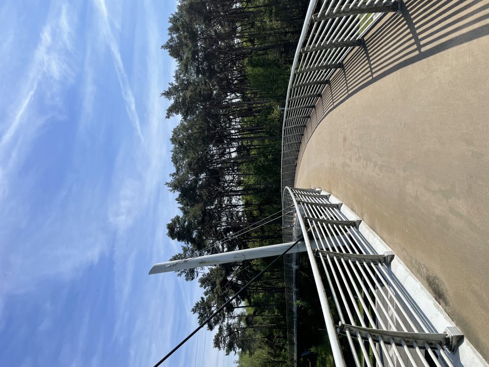
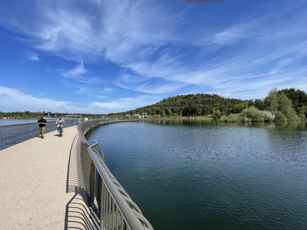
After crossing the cycle bridge, we cycle past the Mechelse Heide and through the Lanklaarderbos to the well-known attraction 'Cycling Through the Mijnterrils'. Across a floating bridge, we experience a unique landscape here, shaped by mining.
Via junctions 502 and 55, we return to Eisden center and end the tour once again at the Vrijthof.
automatic translation
 nodes to follow
0 km

3.3 km
5.3 km
9.8 km
10.1 km
15.6 km
16.3 km
17 km
26.3 km
28.1 km
28.6 km
31.1 km
32.1 km
35.8 km
36 km
40.6 km
42.7 km
43.5 km
46.1 km
48.1 km
48.6 km
48.7 km
48.9 km
57.5 km
59.7 km

60.6 km


 Upgrade to Premium Plus
