 Biking
 Login
Login
 More
More
 EN
EN
 Premium
Along the tracks to Hof ter Linden
automatic translation
31.3 km • Edegem
6.0357 2 4.5/5
route offered by
Toerisme Provincie Antwerpen
 Addresse starting point (approximate)
Vestinglaan (Fort 5), 2650 Edegem
 signage
The route is fully signposted with nodes.
 Description
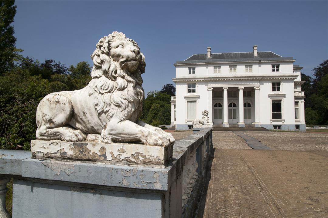
In the valley of the Babbelkroon Brook you will discover a semi-open landscape with beautiful vistas. The provincial floodplain Babbelse Plassen protects Lint from flooding. Take a seat on one of the picnic benches and enjoy nature. Two forest chapels tell the history of this beautiful place. Continue your route along the old railroad line 27B that connected Mechelen and Antwerp-South. After the demolition of the railroad line in 1970, a green corridor was left behind. This forms the movement route for plants and animals through the Zuidrand. In the center of Kontich, you cycle right through the elongated park that forms the Old Railway Embankment there. Have fun in play forest Dikke Bertha in Fort 5 or cycle through the majestic lane of the castle domain Hof ter Linden. On the domain you will find a brasserie and a gourmet restaurant. From June to September you can feast on delicious berries in the picking garden.
automatic translation
 nodes to follow
0 km
3.5 km
5.3 km
7.4 km
11.7 km
14.7 km
16.2 km
17.1 km
19.2 km
21.3 km
22.9 km
23.6 km
25.8 km
28.9 km
30.3 km
31.1 km


 Upgrade to Premium Plus
