 Biking
 Login
Login
 More
More
 EN
EN
 Premium
Follow the valleys to the Solhof
automatic translation
27.6 km • Aartselaar
4.89217 3 1.8/5
route offered by
Toerisme Provincie Antwerpen
 Addresse starting point (approximate)
Kleistraat (zwembad en sporthal), 2630 Aartselaar
 signage
The route is fully signposted with nodes.
 Description
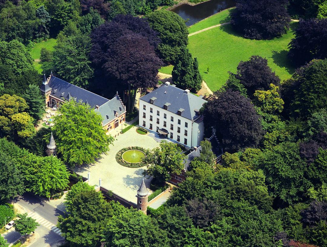
The Great Struis Creek and its side streams meander through the landscape. Along the bike loop you can enjoy vistas of this valley at several spots. In the southern edge you will find several centuries-old castles such as castle domain Cleydael and former courts of plaisance. Observe their towers through the greenery of the castle parks. Castle park Solhof is worth a short break. The castle became a hotel and the beautiful English garden is an oasis of tranquility. Picnicking and romping in the greenery can be done in Park Neerland or the Cleydaelbos. Stop off at the Edegemse beekvallei for a delicious farm ice cream.
automatic translation
 nodes to follow
0 km
2.7 km
3.4 km
5.8 km
9.2 km
10.5 km
12.4 km
12.7 km
15.3 km
16.6 km
17.9 km
18.9 km
20.3 km
20.7 km
21.4 km
24.9 km
25.8 km
27.3 km
Sunday, June 14, 2026 by Tina AntonsenIt all started off really well, but when the passage was blocked, everything went wrong. 😏
automatic translation
Sunday, June 14, 2026 by C.N.This route isn't exactly scenic; it just goes from one village center to another. Didn't see any castles? Didn't see any valleys either! There were also a lot of detours that were poorly marked. At one point, we just had to re-enter our vacation address and head back that way, so no, this was a real letdown!
automatic translation
Friday, May 8, 2026 by F.G.It was a nice route, but there were several unclear detours. I had to look for the way several times. Worse still was a closed bridge. There was just a fence there with no clear detour. Because of this, I had to take a detour of at least 7 km, only to end up at a railway bridge with stairs that I couldn’t cross on my electric bike.
automatic translation


 Upgrade to Premium Plus
