 Hiking
 Login
Login More
More EN
EN Premium
Wolf Pits Hike (Long)
automatic translation
8.7 km • Dilbeek
route offered by
Toerisme Dilbeek
 Addresse starting point (approximate)
Kamerijklaan 46, 1700 Dilbeek
 signage
The route is fully signposted with thematic signs (no nodes).
 Description
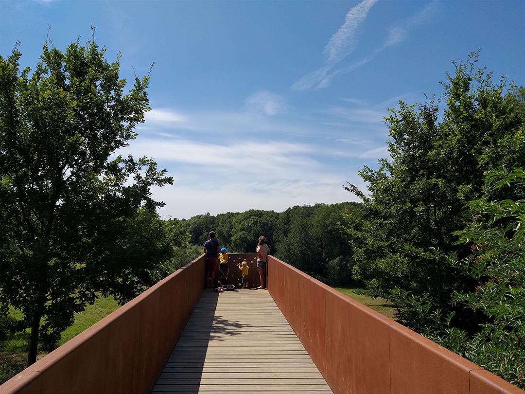
Formerly a sandstone quarry, the Wolfsputten are now a 90-hectare gem of nature reserve and one of the most important in Flanders due to its size, species richness, geological structure and rich history, with its own flora. The walk runs almost entirely through the Wolfsputten. You walk through grasslands and woods. In spring, wood hyacinths are scented in the oak and hornbeam forest. A little further on you step through the small Hermit Forest. Be sure to stop at the suspended viewing platform.
On the way, you walk along plank paths with height differences and narrow paths. Therefore less suitable for strollers.
You can also shorten the walk to 4.6 km. This shortening is also signposted.
More info about the Wolfsputten nature reserve
This walk is offered by the municipality of Dilbeek.
automatic translation
 nodes to follow
0 km
1.6 km
2.2 km
2.8 km
3 km
3.4 km
4.7 km
5.2 km
5.6 km
5.9 km
6.8 km
7.7 km
8.7 km
Thursday, May 26, 2022 by Gundi CAYETThe first part of the hike was particularly beautiful. Unfortunately, we didn't see where to choose the long loop so we did the short one without knowing it. Have heard quite a few people who suggested this. Maybe better mark it anyway because the signs for the short loop are easier to see.
automatic translation
Saturday, February 5, 2022 by A.V.Nice quiet route! Adapted footwear is definitely needed on wet days.
automatic translation
Friday, May 14, 2021 by W.D.Very nice walk, lots of nature, no busy lanes. 1 stretch with slightly narrower path, so people with strollers may have some trouble. Largely through forest, field, meadow
automatic translation


 Upgrade to Premium Plus
