 Hiking
 Login
Login More
More EN
EN Premium
Pleasure Tour Ternell - "so close and yet so far"
19.8 km • Eupen
 official route
1570 0 0/5
route offered by
 Addresse starting point (approximate)
Monschauer Straße - Ternell 2-3, 4700 Eupen
 signage
The route is fully signposted with nodes.
 Description
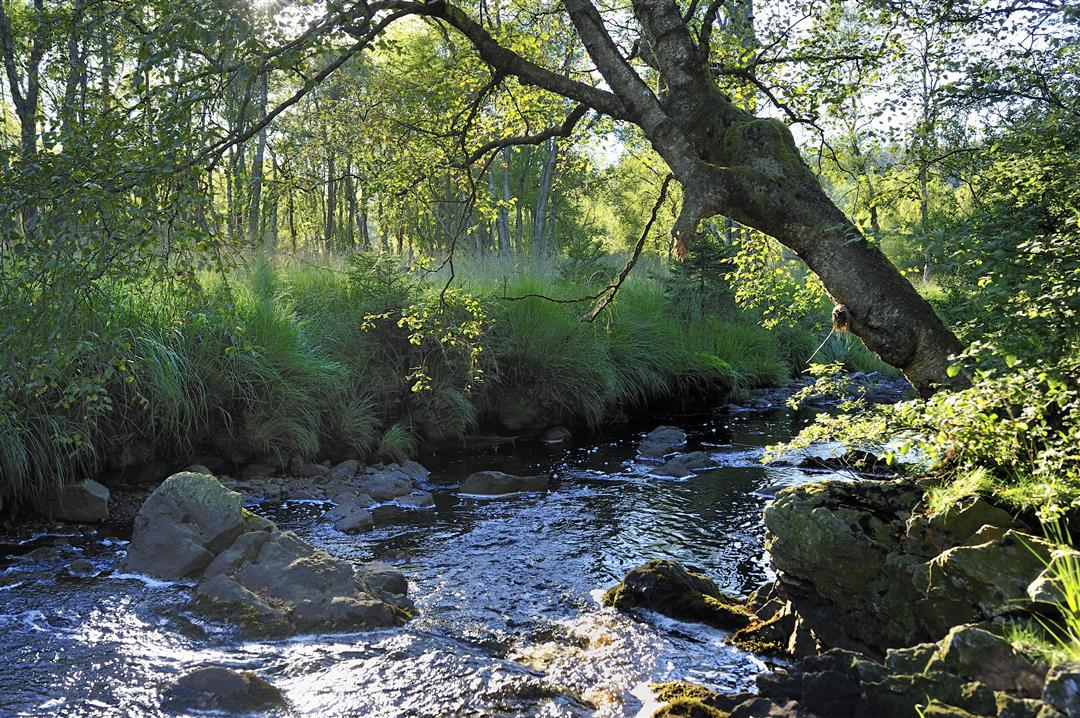
After the shaded terrace and appetising aromas from the inn at Haus Ternell we set off into the valley of the Hill. On the edge of the Hertogenwald the broad trail turns into a steep unmade path. From a long way down below the roar of the Hill makes itself heard, but it can't drown out the twitter of the birds. The Hill is reputed to be untamable. On its banks, it looks gentle and submissive, but as it take its course, it hurls itself into the valley, wild and unchained. As we ascend, we're glad to be able to avail ourselves of the handrail.
At the edge of the wood, the Herzogenhügel bridge appears, via which we make our way on to the plateau. A place that seems to be screened off by the forest from the world outside, because a deep silence has descended here. Via this long climb, we make our way back to Brack Fen, a moor landscape that is less well known, but nonetheless charming for that. Among the tall grasses we come to Rotenbüchel, where the Getzbach rises and its black waters weave their way through the landscape.
Signposting: 62 - 71 - 24 - 64 - 17 - 84 - 1 - 77 - 80 - 71 - 76 - 63 - 32 - 95 - 46 - 65 - 39 - 96 - 62
Parking: at House Ternell
Equipment: hiking shoes with ankle support, water bottle and lunch
 nodes to follow
0 km
0.9 km
2 km
5.8 km
6.2 km
6.8 km
7.9 km
9.2 km
10.8 km
11.9 km
12.3 km
13.7 km
13.7 km
13.8 km
15.5 km
15.6 km
16 km
17.8 km
18.3 km
19.8 km


 Upgrade to Premium Plus
