 Hiking
 Login
Login More
More EN
EN Premium
Kinderdijk Walking Tour
automatic translation
9.2 km • Alblasserdam
route offered by
 Addresse starting point (approximate)
Waalsingel 3, 2953 EX Alblasserdam, Nederland
 signage
The route is fully signposted with nodes.
 Description
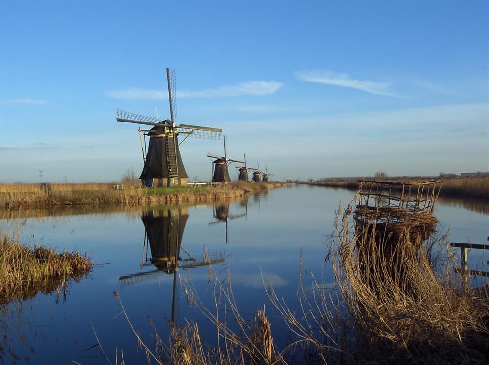
Discover the magical Kinderdijk and its historic mills during this picturesque 9.2 km walking tour. The route leads you along the stately Nederwaard and Overwaard mills, some of which date back to 1738. You can take in the impressive history of the only never raised mill, Nederwaard Mill No. 8, and further admire the enchanting architecture of mills such as the Overwaard Mill No. 4, which has been transformed into a fascinating museum mill.
Do not miss the splendor of the polder mill De Blokker, a solitary beauty with a unique external catching rod. Continue your journey and meet Boezems Kinderdijk, a lush Natura 2000 area with rich flora and fauna. During your relaxing stroll, where stone giants and straight waterways sketch the horizon, you will experience the serene landscape that has been tamed for centuries by these monuments of Dutch engineering. Wrap up your walk with the historic Kortlandse Mill, a beacon of Alblasserdam heritage, before returning to the contemporary world.
automatic translation
 nodes to follow
0 km
0.8 km
1.5 km
1.6 km
2.7 km
2.9 km
3.7 km
5.6 km
6.6 km
6.7 km
6.7 km
7.1 km
8.9 km
9.1 km


 Upgrade to Premium Plus
