 Hiking
 Login
Login More
More EN
EN Premium
From Abbey to Castle
automatic translation
7.9 km • Doetinchem
route offered by
 Addresse starting point (approximate)
Abdijlaan 1, 7004 JL Doetinchem, Nederland
 signage
The route is not signposted. Use a GPS device or our app to follow the route.
 Description
Discover the Sint-Willibrordsabbey and the historical Slangenburg during this 7.9 km walk. You start at the youngest Benedictine abbey in the Netherlands, a place steeped in history and devotion. Admire the architecture that, despite the scarcity of materials after the war, has formed an impressive monastery. The abbey church, a replica of the Romanesque church of Saint Philibert, invites introspection.
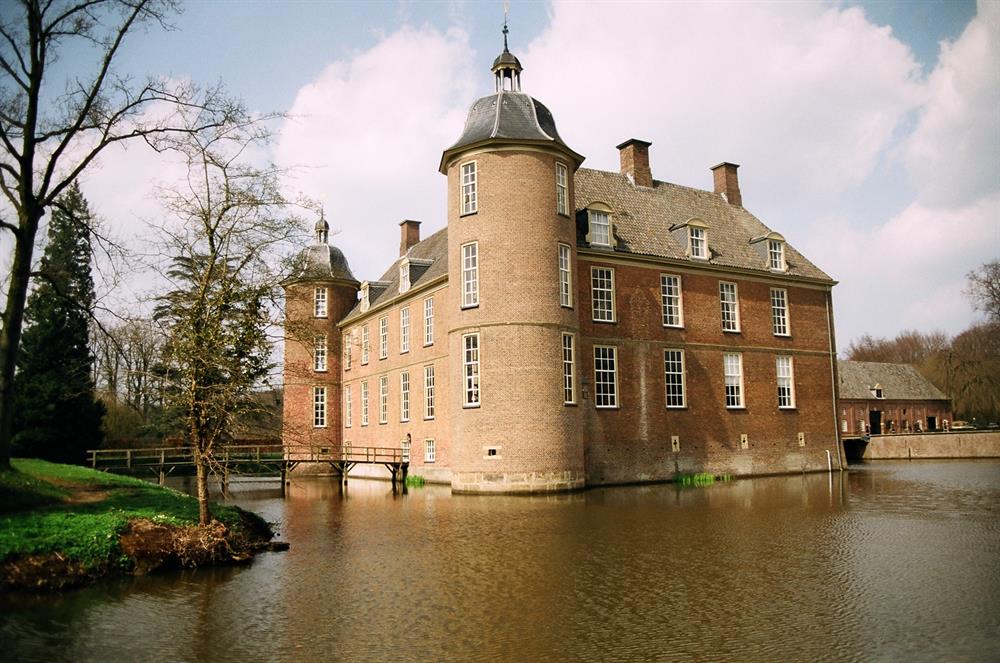
Halfway through the journey, Slangenburg Castle emerges, a jewel in the Gelderland landscape, forming an oasis of calm with its estate. This beautiful estate, managed by the Staatsbosbeheer, offers a unique glimpse into the past and is a welcome stopping point for every hiker. Connect with nature and history on this inspiring route, where everyday life momentarily fades into the background. Complete your walking experience and immerse yourself in the stories and silence that these special places have to offer.
automatic translation
 nodes to follow
0 km
0.2 km
0.5 km
0.7 km
1.5 km
2.4 km
2.8 km
3.4 km
4 km
4 km
4.4 km
4.5 km
5.2 km
6.1 km
6.4 km
7 km
7.6 km
7.9 km


 Upgrade to Premium Plus
