 Hiking
 Login
Login More
More EN
EN Premium
Kampina Trail
automatic translation
11.9 km • Boxtel
route offered by
 Addresse starting point (approximate)
Prins Hendrikstraat 98, 5281 CN Boxtel, Nederland
 signage
The route is fully signposted with nodes.
 Description
Discover the beauty of Brabant's nature and heritage on this 11.9 km-long hiking route. Wander through the vast heaths and forests of the Kampina, an oasis of tranquility between Boxtel and Oisterwijk. This expansive nature area, managed by Natuurmonumenten, invites you to enjoy the colorful flora and fauna. Listen to the call of the curlew and look for the rare tree frog amongst the peaty heath. The meandering streams, the Rosep and the Beerze, add their babbling as a peaceful soundtrack to your walk.
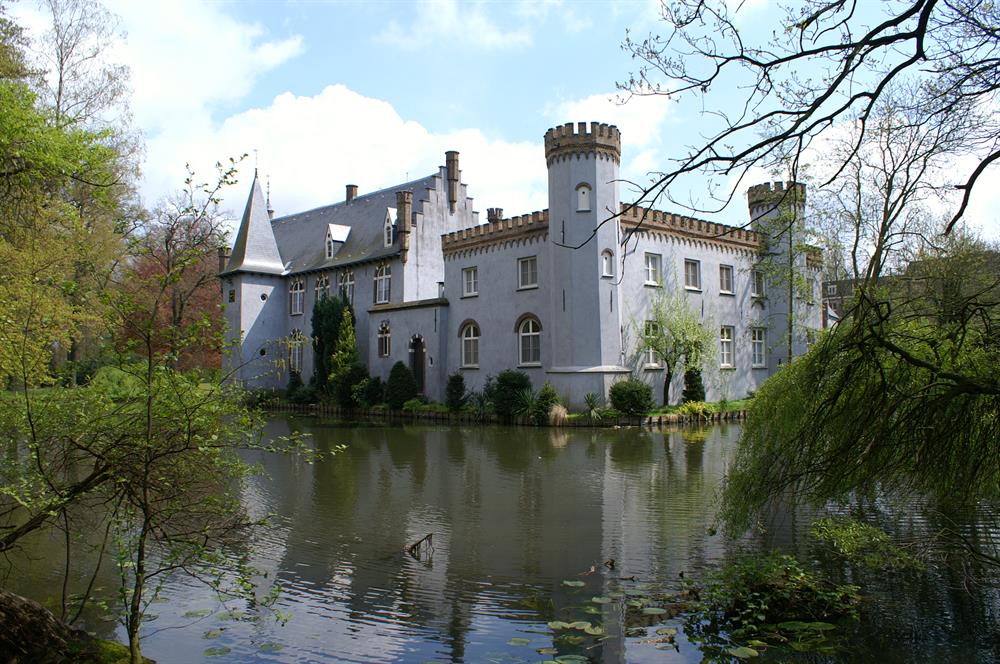
At the end of the route, the historical Stapelen Castle emerges, a gem of Boxtel. This monument, rooted in the 13th century, tells a story of nobility, religion, and continual transformation. Although the castle itself is not accessible, the surrounding park offers beautiful views on this stately home and provides paths surrounded by greenery. As you take in the rich history of the castle and perhaps glance at the gravestones in the park, your route concludes in wonder.
automatic translation
 nodes to follow
0 km
1.3 km
1.5 km
2.2 km
2.7 km
3.5 km
4.5 km
5.8 km
6.8 km
7.2 km
7.7 km
7.8 km
9.3 km
9.5 km
9.8 km
10 km
11 km
11.8 km
11.9 km


 Upgrade to Premium Plus
