 Hiking
 Login
Login More
More EN
EN Premium
Ellewoutsdijk Path
automatic translation
11 km • Borsele
route offered by
 Addresse starting point (approximate)
Wilhelminastraat 25, 4436 AE Oudelande, Nederland
 signage
The route is fully signposted with nodes.
 Description
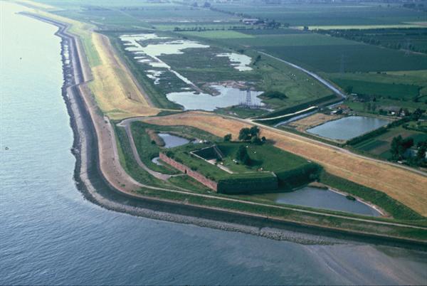
Put on your hiking boots and get ready for an enthralling 11km journey through historical and natural beauty. Your route starts along peaceful paths surrounded by a green landscape, where you can undisturbedly enjoy the singing of birds and the rustling of leaves. Leave the daily bustle behind and breathe in the fresh air as you head towards a special discovery in the midst of nature.
Halfway through your walk, you'll encounter the historic Fort Ellewoutsdijk, an impressive fortification from 1839, now managed by the Society for Nature Conservation. With its rich history as both a bastion and prison, the fort is filled with stories. Walking around the grounds, you can admire the old walls and imagine how soldiers once watched over the safety of the trading city Vlissingen. The fort, which was occupied by the German army during World War II, has received a splendid renovation after many years and is certainly worth a visit. Take a journey through time and uncover the secrets of this location in the heart of nature.
automatic translation
 nodes to follow
0 km
2.6 km
2.8 km
3.5 km
6 km
8 km
10.6 km
11 km


 Upgrade to Premium Plus
