 Biking
 Login
Login More
More EN
EN Premium
Goeree-Overflakkee - western route
54.3 km • Goeree-Overflakkee
route offered by
 Addresse starting point (approximate)
Middelduinpad, 3253 Ouddorp, Nederland
 signage
The route is fully signposted with nodes.
 Description
Begin your bike tour by diving into the past at the striking history of the Flaauwe Werk. The iron lighthouse, designed by Quirinus Harder, testified to Ouddorp's nautical history. And although so the lighthouse is now gone, the spot still appeals to the imagination and is a not-to-be-missed start of your route along fascinating heritage and breathtaking nature.
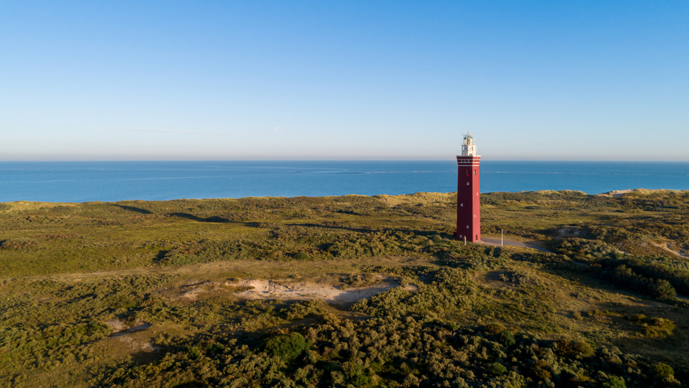
Then you will suddenly see a lighthouse, that of Westhoofd. This beautiful beacon towers stately above the landscape. Pedaling further through the landscape you will find an oasis of tranquility in the Westduinen, an inner dune area full of rare flora and unique fauna. The "Bumpy Meadow," cut off from the sea, has developed its own character with - how could it be otherwise - bumpy meadows, an underground transmitter station and winter quarters for bats in the old bunkers.
You then continue cycling toward the center of Ouddorp before finding, along the Grevelingenmeer and through the meadows, the village of Stellendam on your path. Here you pass the Deltahaven. You can choose to deviate from the route at this point to also view the Goereese Sluis a little further on.
From there you head back towards the starting point with the nature area Dunes of Goeree and Kwade Hoek as your final destination.
automatic translation
 nodes to follow
0 km
2.4 km
4.7 km
8.2 km
10.5 km
14.9 km
16.7 km
18.2 km
20.6 km
27.7 km
29.5 km
31.1 km
35 km
36.2 km
43.2 km
43.5 km
45.6 km
45.7 km
48.8 km
50.3 km
54.2 km


 Upgrade to Premium Plus
