 Biking
 Login
Login More
More EN
EN Premium
Stage 3: Castles, mine site and De Wijers
automatic translation
65.6 km • Riemst
 official route
route offered by
 Addresse starting point (approximate)
Jekerstraat 4 RIEMST
 signage
The route is fully signposted with nodes.
 Description
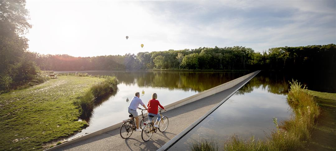
Stage 3 of 6: With the Voer region in the can, we head back north. At the Vroenhoven Bridge we leave the Albert Canal and pedal a rather classic stage. Spicy climbs and even a cobbled section lead us to Alden Biesen. Good news, at the top at the Apostle's House we see the plain stretching north of us. From Bilzen, we once again cross the Albert Canal to Zutendaal. With the Lieteberg and Kattevennen, we pass through a few gateways of the Hoge Kempen National Park. Via the creative C-mine, the tasty Vennestraat and the natural pearl the Maten, we make our entrance at Domein Bokrijk where the arrival is at Cycling through Water. Time to caress the water for your photo on Instagram.
automatic translation
 nodes to follow
0 km
0 km
3.2 km
3.4 km
4.4 km
7.2 km
11.4 km
15.5 km
16.2 km
18.3 km
24.5 km
27.3 km
28.5 km
29.4 km
30.3 km
32.3 km
33.4 km
36.1 km
37.3 km
39.2 km
41 km
43.6 km
45.6 km
48.1 km
48.1 km
48.1 km
48.1 km
48.1 km
49.1 km
49.2 km
49.2 km
51.1 km
52 km
59.4 km
61.4 km
63.7 km
65.6 km


 Upgrade to Premium Plus
