 Biking
 Login
Login More
More EN
EN Premium
Cycling around Wierickerschans
automatic translation
53.1 km • De Ronde Venen
route offered by
 Addresse starting point (approximate)
Stationsweg 2, 3648 AN Wilnis, Nederland
 signage
The route is fully signposted with nodes.
 Description
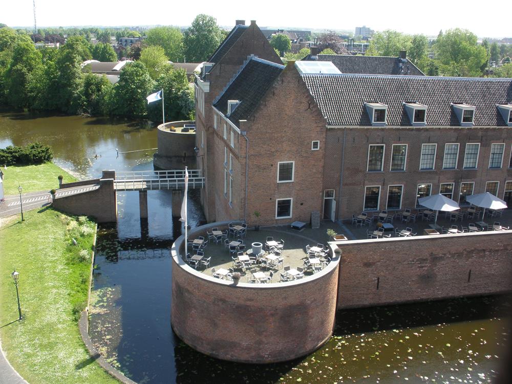
You will pass by the imposing Castle of Woerden, where Duke John of Bavaria laid the foundation for a rich history that dates back to the 15th century. Admire its square shape, the drawbridge and feel the history of the place where the castle was once the scene of battles and political intrigues. After embracing the history of Woerden, the route leads you to Fort Wierickerschans, a unique piece of defensive work from the 17th century. This fort, strategically placed at the intersection of waterways, tells stories about the Old Dutch Waterline and has had many functions over the years, making it a fascinating stop.
The route continues towards the polder where the Westveense Mill proudly adorns the horizon. This polder mill from 1676 marks the rich water management history of the region. With its vanes against the wind, you find yourself here at the pivot point of Utrecht and South Holland. Brought in as heritage by Het Utrechts Landschap, the mill stands as an oasis of tranquility and a reminder of the Dutch struggle against water.
automatic translation
 nodes to follow
0 km
4 km
4.2 km
6.7 km
8 km
11.5 km
11.7 km
12.7 km
13 km
14.1 km
21.9 km
23.3 km
24.3 km
26 km
31.5 km
33.5 km
36.7 km
39.4 km
41.6 km
42.1 km
42.6 km
47.3 km
47.5 km
53 km


 Upgrade to Premium Plus
